Eye on Infinity: NASA Celebrates Hubble’s 35th Year in Orbit
NASA, ESA, STScI; Image Processing: Joseph DePasquale (STScI), Alyssa Pagan (STScI)
In celebration of the Hubble Space Telescope’s 35 years in Earth orbit, NASA is releasing an assortment of compelling images recently taken by Hubble, stretching from the planet Mars to star-forming regions, and a neighboring galaxy.
After more than three decades of perusing the universe, Hubble remains a household name — the most well-recognized and scientifically productive telescope in history. The Hubble mission is a glowing success story of America’s technological prowess, unyielding scientific curiosity, and a reiteration of our nation’s pioneering spirit.
“Hubble opened a new window to the universe when it launched 35 years ago. Its stunning imagery inspired people across the globe, and the data behind those images revealed surprises about everything from early galaxies to planets in our own solar system,” said Shawn Domagal-Goldman, acting director of the Astrophysics Division at NASA Headquarters in Washington. “The fact that it is still operating today is a testament to the value of our flagship observatories, and provides critical lessons for the Habitable Worlds Observatory, which we plan to be serviceable in the spirit of Hubble.”
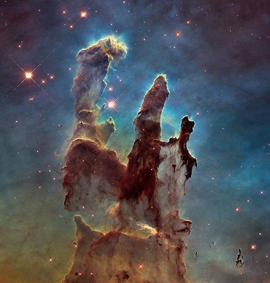
Perched above Earth’s blurry atmosphere, Hubble’s crystal-clear views have been nothing less than transformative for the public’s perception of the cosmos. Through its evocative imagery, Hubble has made astronomy very relevant, engaging, and accessible for people of all ages. Hubble snapshots can portray the universe as awesome, mysterious, and beautiful — and at the same time chaotic, overwhelming, and foreboding.

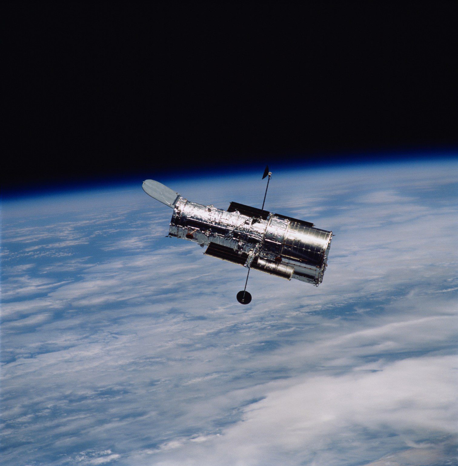
The 24,000-pound observatory was tucked away inside the space shuttle Discovery’s cargo bay and lofted into low Earth orbit on April 24, 1990. As the shuttle Discovery thundered skyward, the NASA commentator described Hubble as a “new window on the universe.” The telescope turned out to be exactly as promised, and more.
More scientific papers than ever are based on Hubble data, thanks to the dedication, perseverance, and skills of engineers, scientists, and mission operators. Astronauts chased and rendezvoused with Hubble on five servicing missions in which they upgraded Hubble’s cameras, computers, and other support systems. The servicing missions took place from 1993 to 2009.
The telescope’s mission got off to a shaky start in 1990 when an unexpected flaw was found in the observatory’s nearly eight-foot diameter primary mirror. Astronauts gallantly came to the rescue on the first shuttle servicing mission in December 1993 to improve Hubble’s sharpness with corrective optics.
To date, Hubble has made nearly 1.7 million observations, looking at approximately 55,000 astronomical targets. Hubble discoveries have resulted in over 22,000 papers and over 1.3 million citations as of February 2025. All the data collected by Hubble is archived and currently adds up to over 400 terabytes, representing the biggest dataset for a NASA astrophysics mission besides the James Webb Space Telescope.
Hubble’s long operational life has allowed astronomers to return to the same cosmic scenes multiple times to observe changes that happened during more than three decades: seasonal variability on the planets in our solar system, black hole jets travelling at nearly the speed of light, stellar convulsions, asteroid collisions, expanding supernova bubbles, and much more.
Credit: NASA’s Goddard Space Flight Center; Lead Producer: Paul Morris; Narrator: Dr. Jennifer Wiseman
Before 1990, powerful optical telescopes on Earth could see only halfway across the cosmos. Estimates for the age of the universe disagreed by a big margin. Supermassive black holes were only suspected to be the powerhouses behind a rare zoo of energetic phenomena. Not a single planet had been seen around another star.
Among its long list of breakthroughs: Hubble’s deep field images unveiled myriad galaxies dating back to the early universe. The telescope also allowed scientists to precisely measure the universe’s expansion, find that supermassive black holes are common among galaxies, and make the first measurement of the atmospheres of exoplanets. Hubble also contributed to the discovery of dark energy, the mysterious phenomenon accelerating the expansion of universe, leading to the 2011 Nobel Prize in Physics.
The relentless pace of Hubble’s trailblazing discoveries kick-started a new generation of space telescopes for the 21st century. Hubble provided the first observational evidence that there were myriad distant galaxies for Webb to pursue in infrared wavelengths that reach even farther beyond Hubble’s gaze. Now, Hubble and Webb are often being used in complement to study everything from exoplanets to galaxy evolution.
Hubble’s planned successor, the Habitable Worlds Observatory, will have a significantly larger mirror than Hubble’s to study the universe in visible and ultraviolet light. It will be significantly sharper than Hubble and up to 100 times more sensitive to starlight. The Habitable Worlds Observatory will advance science across all of astrophysics, as Hubble has done for over three decades. A major goal of the future mission is to identify terrestrial planets around neighboring stars that might be habitable.
The Hubble Space Telescope continues to make ground-breaking discoveries that shape our fundamental understanding of the universe. Hubble is a project of international cooperation between NASA and ESA (European Space Agency). NASA’s Goddard Space Flight Center in Greenbelt, Maryland, manages the telescope and mission operations. Lockheed Martin Space, based in Denver, also supports mission operations at Goddard. The Space Telescope Science Institute in Baltimore, which is operated by the Association of Universities for Research in Astronomy, conducts Hubble science operations for NASA.
Related Images & Videos
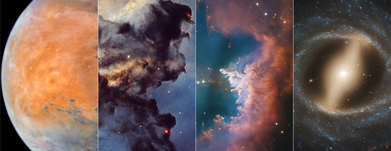
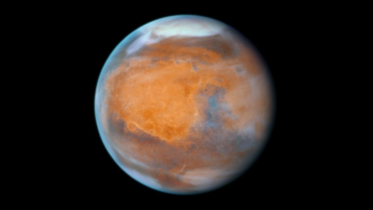
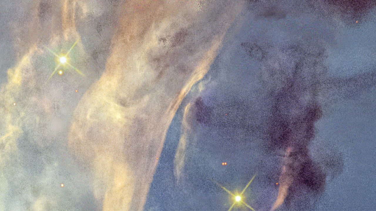
Mosaic of Hubble 35th Anniversary Targets
A selection of photogenic space targets to celebrate the 35th anniversary of NASA’s Hubble Space Telescope. Upper left: Mars. Upper right: planetary nebula NGC 2899. Lower left: a small portion of the Rosette Nebula. Lower right: barred spiral galaxy NGC 5335.


Rosette Nebula Context Image
The Rosette Nebula is a vast star-forming region, 100 light-years across, that lies at one end of a giant molecular cloud. The background image is from the Digitized Sky Survey, while the inset is a small portion of the nebula as photographed by the Hubble Space Telescope.


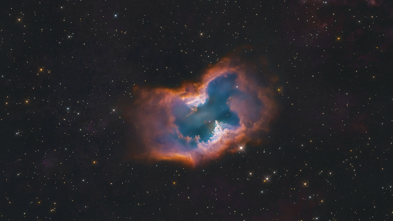
Planetary Nebula NGC 2899
This video zooms across 6,500 light-years through a star-studding field to visit the planetary nebula NGC 2899, as photographed by the Hubble Space Telescope. The nebula has a diagonal bipolar structure formed by a cylindrical-shaped outflow of hot gasses and radiation from the c…
Share
Details
Claire Andreoli
NASA’s Goddard Space Flight Center
Greenbelt, Maryland
claire.andreoli@nasa.gov
Ray Villard
Space Telescope Science Institute
Baltimore, Maryland


