Tag: space

  • NASA Lab Builds New Aircraft to Support Complex Flight Research

    2 min read

    Preparations for Next Moonwalk Simulations Underway (and Underwater)

    NASA’s Armstrong Flight Research Center in Edwards, California, is building a new subscale aircraft to support increasingly complex flight research, offering a more flexible and cost-effective alternative to crewed missions.

    The aircraft is being built by Justin Hall, chief pilot at NASA Armstrong’s Dale Reed Subscale Flight Research Laboratory, and Justin Link, a small uncrewed aircraft pilot. The duo is replacing the center’s aging MicroCub subscale aircraft with a more capable platform that will save time and reduce costs. The new aircraft spans about 14 feet from wingtip to wingtip, measures nine-and-a-half feet long, and weighs about 60 pounds.

    The subscale laboratory accelerates innovation by using small, remotely piloted aircraft to test and evaluate new aerodynamic concepts, technologies, and flight control systems. Named after aerospace pioneer Dale Reed, the lab enables rapid prototyping and risk reduction before transitioning to full-scale or crewed flight testing. Its work plays a key role in increasing technology readiness to support NASA’s missions on Earth and beyond.

    Hall and Link are modifying an existing subscale aircraft kit by adding a more powerful engine, an autopilot system, instrumentation, and a reinforced structure. The aircraft will offer greater flexibility for flight experiments, enabling more frequent and affordable testing compared to crewed aircraft.

    One example of its potential is the Robust Autonomous Aerial Recapture project, which uses sensors and video with advanced programming to learn and adapt for mid-air capture. The system relies on a magnetic connection mechanism integrated onto the two aircraft.

    This capability could support future science missions in which a mothership deploys drones to collect samples, recharge, and redeploy for additional missions, saving fuel, reducing cost, and increasing efficiency. Aerial recapture work is funded by the NASA Armstrong Center Innovation Fund and the Space Technology Mission Directorate.

    Details

    Last Updated

    Sep 24, 2025

    Editor
    Dede Dinius
    Contact

  • NASA Aircraft Coordinate Science Flights to Measure Air Quality

    4 min read

    NASA Aircraft Coordinate Science Flights to Measure Air Quality

    The image shows an aerial view of the Chesapeake Bay, with groves of trees, rivers, a body of water in the distance, and green land. The horizon, a third of the way down the image, separates the blue cloudy sky from the land. On the right of the image is a white wing of a plane.
    NASA Goddard’s G-LiHT flying on the A90 flies over Shenandoah Valley in the US East Coast during the week of August 11-15.
    Credit: Shawn Serbin/NASA GSFC

    Magic is in the air. No wait… MAGEQ is in the air, featuring scientists from NASA centers across the country who teamed up with the National Oceanic and Atmospheric Administration (NOAA), the University of Maryland Baltimore County, and several other university and government partners and collaborators.

    This summer, six planes collectively flew more than 400 hours over the mid-Atlantic United States with a goal of gathering data on a range of objectives, including air quality, forestry, and fire management.

    This was part of an effort called MAGEQ, short for Mid-Atlantic Gas Emissions Quantification. Rather than one mission, MAGEQ consists of several individual missions across more than a dozen organizations and agencies, along with university students. Over the course of around six weeks, aircraft flew over cities, wetlands, farms, and coal mining areas.

    An aerial view of Shenandoah, showing green mountains and land. The horizon separates the bright blue sky from the land. At the top of the image is a reflection of inside the aircraft, showing this image was taken through a window. At the bottom of the image is a white wing of a plane and the engine and propellor of the same plane.
    NASA Goddard’s G-LiHT flying on the A90 flies over the Chesapeake Bay near the Big Annemessex River.
    Credit: Shawn Serbin/NASA GSFC

    “Each aircraft team is comprised of highly skilled and motivated people who understand how to fly their particular plane to achieve the science they want,” said Glenn Wolfe, research scientist at NASA’s Goddard Space Flight Center in Greenbelt, Maryland, and project lead for MAGEQ. “The complexity comes in identifying how each platform can complement or supplement the others.”

    Coordinating flights required both advanced planning and flexibility to get the best outcome. Weather proved to be a primary challenge for the team, as members worked around cloudy days, wind, and storms to ensure safe flights.

    The six aircraft had different objectives and requirements. For example, some carried instruments that needed to fly high to simulate a satellite’s view of the atmosphere and the Earth’s surface and could not measure through clouds. Others were equipped with instruments that directly measured the air particles and could work under the clouds, provided there was no rain.

    Despite weather challenges, flight teams worked together to coordinate as many multi-aircraft flight days as possible, meeting the overall objective of the MAGEQ campaign.

    A group of twenty one people stand in front of a large, white aircraft with propellors. The NASA meatball logo is seen on the side of the aircraft. The people are all smiling and looking at the camera.
    The MAGEQ team members pose in front of the P-3 aircraft.
    Credit: Roy Johnson/NASA

    “It’s been inspiring to see how everybody worked together,” said Lesley Ott, research meteorologist and lead carbon cycle modeler for NASA’s Global Modeling and Assimilation Office at NASA Goddard. “By collecting data together, not only can we do a better job as scientists in having more complete understanding, we can also do a better job making usable data sets that meets the needs of different stakeholders.”

    State resource managers in North Carolina and Virginia, for example, could benefit from this data as they monitor the health of wetlands, which provide resilience to storms, absorb carbon from the atmosphere and support local tourist industries. The data could also help operators at energy-producing facilities detect methane leaks or equipment failures quickly. Faster detection could speed up intervention and minimize waste, as well as lessen environmental impacts. Stakeholders were an integral part of the planning process, Ott said. They made suggestions about measurement sites and data needs that informed the flight planning.

    Scientists will also use the measurements to verify satellite data from both public and commercial data providers. Satellites like the Tropospheric Emissions: Monitoring of Pollution (TEMPO) instrument collect similar data. Scientists can compare the airborne and satellite data to get a more complete picture of the atmosphere. They also will use MAGEQ data to evaluate atmospheric chemistry modeling from the Goddard Earth Observing System (GEOS) model, which connects atmospheric, oceanic, and land data to help create a more comprehensive picture of Earth science.

    A group of seventeen people stand in a line in front of a blue aircraft with propellors. They all smile at the camera, which is taking a picture of them from a distance.
    The MAGEQ team members from NOAA and NASA pose in front of the Twin Otter aircraft.
    Credit: Steve Brown

    “Every aircraft does something different and contributes a different type of data,” said Steve Brown, leader of the tropospheric chemistry and atmospheric remote sensing programs at the NOAA Chemical Sciences Laboratory in Boulder, Colorado. “We’re going to have a lot of work to do at the end of this to put all these data sets together, but we will make the best use of all these measurements.”

    By Erica McNamee

    NASA’s Goddard Space Flight Center, Greenbelt, Md.

    Details

    Last Updated

    Sep 24, 2025

    Editor
    Jenny Marder
    Contact
    Erica McNamee
    Location
    Goddard Space Flight Center
  • NASA Data Powers New Tool to Protect Water Supply After Fires

    6 Min Read

    NASA Data Powers New Tool to Protect Water Supply After Fires

    Wildfire-scorched hills with charred trees rise above a body of water under a hazy, smoke-filled sky.

    Wildfire-scorched terrain above a water body underscores risks to downstream supplies.

    Credits:
    USFS/Cecilio Ricardo

    When wildfires scorch a landscape, the flames are just the beginning. NASA is helping communities across the nation foresee and prepare for what can follow: mudslides, flash flooding, and contaminated surface water supplies.

    A new online tool called HydroFlame, built with support from NASA’s Earth Science Division, relies on satellite data, hydrologic modeling, and artificial intelligence to predict how wildfires could affect water resources, from tap water to the rivers and streams where people fish. The project is being developed with the University of Texas at Arlington, Purdue University, the U.S. Geological Survey, and other partners.

    For now, the tool includes data only for Montana’s Clark Fork Basin, where it is being piloted. But new applications are underway in California and Utah. Researchers will soon begin fieldwork in Los Angeles County to collect on-the-ground data to refine HydroFlame’s predictive approach — an important step toward expanding it beyond the pilot site.

    “As wildfires intensify across the country, so do their ripple effects on regional water resources,” said Erin Urquhart, program manager for NASA’s water resources program at NASA Headquarters in Washington. “HydroFlame could help communities in the U.S. see what’s coming and plan for it, before a fire becomes a water crisis.”

    That kind of foresight is exactly what local officials are looking for.

    “For someone managing a trout fishery or drinking water supply, knowing when a stream might be overwhelmed with debris after a fire can mean the difference between preparedness and a crisis,” said Morgan Valliant, who is part of the project’s advisory group and the associate director of ecosystem services for Missoula Parks and Recreation in Montana. “This tool could let us move from reacting to planning.”

    When fire reshapes land

    In the wake of a wildfire, charred hillsides are often unstable. With the protective blanket of plants burned away, rain that once soaked gently into the soil can race downhill, sending ash, debris, and sediment into rivers and reservoirs. That runoff can trigger flash floods and contaminate drinking water.

    Severe wildfires can also bake soil into a water-repelling crust. With less absorption, the same slopes can swing from drought to destructive floods, and those runoff risks can persist for decades.

    HydroFlame, developed by a team led by Adnan Rajib at the University of Texas at Arlington, is built to anticipate those extremes.

    “NASA is constantly pushing the boundaries when it comes to sensing and predicting fire,” Rajib said. “But there is still a huge gap when it comes to translating that fire information in terms of water. That’s where HydroFlame comes in.” 

    The tool will include three components:

    • a historical viewer that maps past fire impacts on streamflow and sediment
    • a “what-if” scenario builder to simulate future fires
    • a predictive tool that generates weekly forecasts using near-real-time satellite data as initial conditions

    When a wildfire is identified, the tool will identify how severely areas are burned across watersheds and track shifts in vegetation, soil wetness, and evapotranspiration, or the release of water from the land and plants to the atmosphere. HydroFlame uses data from satellite missions and instruments including MODIS (Moderate Resolution Imaging Spectroradiometer), Landsat, and SMAP (Soil Moisture Active Passive).

    Those observations, combined with stream records from gauged rivers, feed into simulations of possible fire-driven changes in water flow and quality. A machine-learning component will fill in where gauges are absent, making it possible to predict impacts up to two weeks in advance.

    HydroFlame’s online interface shows historical fire data for Montana’s Clark Fork Basin watershed from 2006 to 2020.
    This screenshot shows HydroFlame, a NASA-supported online tool that will help U.S. communities better understand and forecast how wildfires may affect water supplies in their region.
    A. Rajib

    The historical viewer, which is publicly accessible, lets users explore how past fires altered streamflow and sediment levels across the basin. The other components are still in development: The prototype of the “what-if” scenario builder tool is expected to launch in December 2025, with the full version planned for May 2026.

    HydroFlame’s ability to capture compounding factors — drought before a fire, flooding afterward — and simulate their cascading effects on water systems is what makes it different from other tools, Rajib said. “Many traditional models treat each fire as a one-off,” he said. “HydroFlame looks at the bigger picture.”

    Just as important, the tool is built for people who aren’t experts in satellite data.

    “It’s a practical starting point for scenario planning,” said Kelly Luis, associate program manager for NASA’s water resources program and an aquatic ecosystem scientist at NASA’s Jet Propulsion Laboratory in Southern California. The tool’s “what-if” function, she explained, will let water managers, city planners, and other officials apply their local knowledge. For example, they might zero in on the rivers and streams most important to a city’s water supply. “That kind of insight is essential for building solutions that are both scientifically grounded and locally relevant.”

    For watershed organizations or local and state agencies with limited staff and resources, that ease of use is crucial — saving time and effort while helping keep costs down.

    “These groups need holistic ways to understand potential impacts of fires to their rivers and streams and plan, without always having to bring in someone from the outside,” said Amy Seaman, the executive director of the Montana Watershed Coordination Council. Seaman works with community watershed organizations across Montana and is also part of the project’s advisory group.

    This effort is part of a broader NASA focus on understanding how fire reshapes water systems and what that means for American communities.

    A real-world trial in Los Angeles

    Rajib’s team put HydroFlame’s predictive capabilities to the test during the January 2025 wildfires in Los Angeles. As fires burned through the region, researchers ran real-time model simulations using NASA satellite data, tracking changes in vegetation, soil moisture, and burn severity almost as they happened. By the end of the month, the team had generated forecasts for mud and debris flows expected in February.

    False-color Landsat 9 image from Jan. 14, showing burned areas near Los Angeles. Green indicates vegetation; brown shades show land burned in the Kenneth, Franklin, and Palisades fires.
    This false-color Landsat 9 image, acquired Jan. 14, shows burned areas from the 2025 fires in and around Los Angeles, highlighting unburned vegetation (green) and burned land (light to dark brown) using shortwave infrared, near infrared, and visible light. Similar types of NASA fire data are used in HydroFlame.
    NASA Earth Observatory

    Those predictions turned out to be accurate. In early February, mudflow events struck the areas of Altadena and Sierra Madre in Los Angeles County, following the Eaton Fire. HydroFlame had been run specifically for that fire and flagged both neighborhoods as at risk, Rajib said.

    “It wasn’t a formal, data-verified result because we didn’t have ground sensors in place,” Rajib said. “But it was a practical validation. The timing and severity of what we modeled lined up with what occurred.”

    Rajib’s team is now working with NASA JPL, the University of California, Merced and Los Angeles County to formally test and expand the tool in the Los Angeles area. The team plans to begin collecting on-the-ground data no earlier than Friday, Sept. 26. That work will include installing stream sensors to measure sediment levels in the county’s streams during California’s rainy season and integrating those data into the tool — a step toward building an early-warning system.

    HydroFlame invites those interested in the tool to share their ideas and feedback, and to get involved, through a web form available on the project’s Explore Tools webpage.

    About the Author

    Emily DeMarco

    Emily DeMarco

    Details

    Last Updated

    Sep 24, 2025

    Location
    NASA Headquarters
  • Airplane Aerobatics

    Airplane Aerobatics

    NASA astronaut Nick Hague watches as Robert Schmidle Pitts Aerobatics perform, Friday, Sept. 12, 2025, during the Joint Base Andrews Air Show at Joint Base Andrews in Prince George’s County, Maryland. Hague spent 171 days aboard the International Space Station as part of Expedition 72.

  • Help Map the Moon’s Molten Flows!

    1 min read

    Help Map the Moon’s Molten Flows!

    moon surface
    Cooled, lava-like flows of impact melt that streamed out of Little Lowell Crater. As a volunteer for the Lunar Melt Citizen Science Project, you’ll help identify and measure rocks and craters in images like this one.
    Credit: NASA/GSFC/Arizona State University

    When asteroids hit the Moon, the impacts carve out craters and with enough energy and pressure, melt parts of the rocky surface. Often, the white hot, gooey melt (it’s like lava, except that it doesn’t erupt from underground) sloshes around the new crater and surrounding regions. The molten rock cools and hardens into vast rock features called impact melt flow deposits. These flow deposits are sculpture-like abstract art with beautiful lines and textures.

    Now, scientists at the Lunar Melt citizen science project are asking for your help mapping these flows. You’ll be marking rocks, measuring the lengths of boulders, and outlining craters and melt deposits in images from NASA’s Lunar Reconnaissance Orbiter spacecraft.

    Your contributions will help reveal how impact melt has changed the Moon’s surface, especially around Little Lowell Crater and Tycho Crater, and help scientists use impact melt flows to learn about the moon’s interior.

    Help planetary scientists map the geology of lava-like flows on the Moon! Sign up at mappers.psi.edu, and tell your friends!

    Details

    Last Updated

    Sep 24, 2025

  • Airplane Aerobatics

    A man in a dark blue jumpsuit faces away from the camera, watching a plane in the light blue sky. He shades his eyes with his right hand.
    NASA/Bill Ingalls

    NASA astronaut Nick Hague watches as Robert Schmidle Pitts Aerobatics perform, Friday, Sept. 12, 2025, at Joint Base Andrews in Prince George’s County, Maryland. Hague spent 171 days aboard the International Space Station as part of Expedition 72.

    While aboard the orbital laboratory, Hague and fellow NASA astronauts Suni Williams and Butch Wilmore completed more than 900 hours of research between more than 150 unique scientific experiments and technology demonstrations. Some of the research conducted included growing microalgae that could convert carbon dioxide into oxygen for the crew to breathe and testing an exercise device to keep crews healthy on long-duration missions.

    Image credit: NASA/Bill Ingalls

  • La NASA y la NOAA lanzan tres naves espaciales para cartografiar la influencia del Sol en el espacio

    A SpaceX Falcon 9 rocket carrying NASA’s IMAP (Interstellar Mapping and Acceleration Probe), Carruthers Geocorona Observatory, and the National Oceanic and Atmospheric Administration’s (NOAA) Space Weather Follow On-Lagrange 1 (SWFO-L1) missions launches from the agency’s Kennedy Space Center in Florida, Wednesday, Sept. 24, 2025.
    Un cohete Falcon 9 de SpaceX que transporta las misiones Sonda de Cartografía y Aceleración Interestelar (IMAP, por su acrónimo en inglés) y el Observatorio Carruthers de la Geocorona, ambos de la NASA, y la nave espacial de Seguimiento de la Meteorología Espacial en el Punto de Lagrange 1 (SWFO-L1, por sus siglas en inglés) de la NOAA, despega desde el Centro Espacial Kennedy de la NASA en Florida el miércoles 24 de septiembre de 2025.
    Crédito: NASA

    Read this press release in English here.

    La NASA y la Administración Nacional Oceánica y Atmosférica (NOAA, por sus siglas en inglés) lanzaron el miércoles tres nuevas misiones para investigar la influencia del Sol en todo el sistema solar.

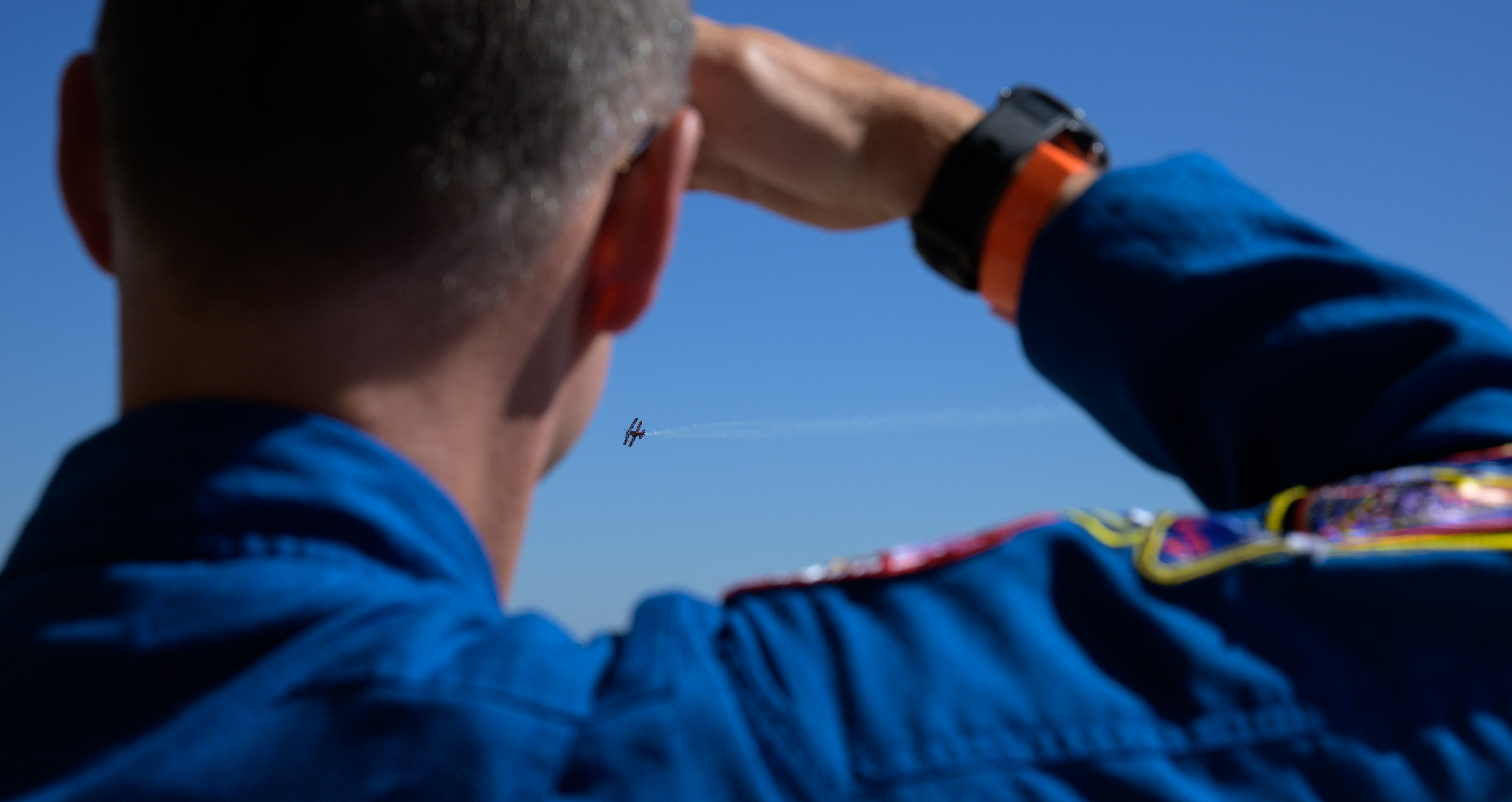
    A las 7:30 a. m. EDT, un cohete Falcon 9 de SpaceX despegó del Complejo de Lanzamiento 39A del Centro Espacial Kennedy de la NASA en Florida, llevando a bordo las misiones Sonda de Cartografía y Aceleración Interestelar (IMAP, por su acrónimo en inglés) y el Observatorio Carruthers de la Geocorona, ambos de la NASA, y la nave espacial de Seguimiento de la Meteorología Espacial en el Punto de Lagrange 1 (SWFO-L1, por sus siglas en inglés) de la NOAA.

    “Este exitoso lanzamiento mejora la preparación de nuestro país ante las condiciones meteorológicas espaciales para proteger mejor nuestros satélites, misiones interplanetarias y astronautas que viajan al espacio de los peligros de la meteorología espacial en todo el sistema solar”, afirmó el administrador interino de la NASA, Sean Duffy. “Esta información será fundamental a medida que nos preparamos para futuras misiones a la Luna y Marte con la intención de mantener a Estados Unidos a la vanguardia en el espacio”.

    Estas misiones ayudarán a proteger de las duras condiciones de la meteorología espacial tanto a nuestra tecnología basada en tierra como a nuestros exploradores espaciales humanos y robóticos.

    “Mientras Estados Unidos se prepara para enviar a seres humanos de vuelta a la Luna y más adelante a Marte, la NASA y la NOAA están proporcionando la guía definitiva de supervivencia interplanetaria para dar apoyo a este épico viaje de la humanidad”, afirmó Nicola Fox, administradora asociada de la Dirección de Misiones Científicas de la sede central de la NASA en Washington. “Nuestros descubrimientos científicos e innovaciones técnicas se incorporan directamente a nuestro plan de acción know-before-you-go (infórmate antes de ir) para garantizar una presencia humana bien preparada, segura y continua en otros mundos”.

    Nueva ciencia para proteger a la sociedad

    Cada misión investigará los diferentes efectos de la meteorología espacial y el viento solar, el cual es un flujo continuo de partículas emitidas por el Sol, desde su origen en nuestra estrella hasta el espacio interestelar.

    “Estas tres misiones únicas nos ayudarán a conocer nuestro Sol y sus efectos sobre la Tierra mejor que nunca”, afirmó Joe Westlake, director de la División de Heliofísica en la sede central de la NASA. “Este conocimiento es fundamental, ya que la actividad solar afecta directamente a nuestra vida cotidiana, desde las redes eléctricas hasta el GPS. Estas misiones nos ayudarán a garantizar la seguridad y la resiliencia de nuestro mundo interconectado”.

    La misión IMAP trazará los límites de la heliosfera, una burbuja inflada por el viento solar que protege nuestro sistema solar de los rayos cósmicos galácticos. Esta es una protección clave que contribuye a que nuestro planeta sea habitable. Además, la nave espacial tomará muestras y medirá las partículas del viento solar que fluyen hacia el exterior desde el Sol, así como las partículas energéticas que fluyen hacia el interior desde los límites de nuestro sistema solar y más allá.

    “IMAP nos ayudará a comprender mejor cómo el entorno espacial puede perjudicarnos a nosotros y a nuestras tecnologías, y a descubrir la ciencia de nuestro vecindario solar”, afirmó David McComas, investigador principal de la misión IMAP en la Universidad de Princeton, en Nueva Jersey.

    El Observatorio Carruthers de la Geocorona es la primera misión dedicada a medir los cambios en la capa más externa de nuestra atmósfera, la exosfera, la cual juega un papel importante en cómo la Tierra responde a la meteorología espacial. Al estudiar la geocorona —el brillo ultravioleta que emite la exosfera cuando la luz del sol la ilumina— la misión Carruthers revelará cómo la exosfera responde a las tormentas solares y cómo cambia con las estaciones. La misión se basa en el legado del primer instrumento que capturó imágenes de la geocorona, el cual viajó a la Luna a bordo de Apolo 16 y fue construido y diseñado por el científico, inventor, ingeniero y educador Dr. George Carruthers.

    “La misión Carruthers nos mostrará cómo funciona la exosfera y nos ayudará a mejorar nuestra capacidad para predecir los efectos de la actividad solar aquí en la Tierra”, dijo Lara Waldrop, investigadora principal de la misión en la Universidad de Illinois en Urbana-Champaign.

    La nave SWFO-L1 de la NOAA, la primera de su tipo, está diseñada para ser un observatorio de meteorología espacial operativo a tiempo completo. Al vigilar la actividad solar y las condiciones espaciales cerca de la Tierra las 24 horas del día, los 7 días de la semana, sin interrupciones ni obstrucciones, SWFO-L1 proporcionará pronósticos de meteorología espacial más rápidos y precisos que nunca.

    “Se trata del primero de una nueva generación de observatorios de meteorología espacial de la NOAA dedicados a operaciones ininterrumpidas, que trabajarán para evitar lagunas en la continuidad. Las observaciones en tiempo real de SWFO-L1 proporcionarán a los operadores los datos fiables necesarios para emitir alertas tempranas, de modo que los responsables de la toma de decisiones puedan actuar con antelación para proteger las infraestructuras vitales, los intereses económicos y la seguridad nacional en la Tierra y en el espacio. Se trata de proteger a la sociedad contra los peligros de la meteorología espacial”, dijo Richard Ullman, subdirector de la Oficina de Observaciones de la Meteorología Espacial de la NOAA

    Siguientes pasos

    En las horas posteriores al lanzamiento, las tres naves espaciales se desplegaron desde el cohete con éxito y enviaron señales a la Tierra para confirmar que están activas y funcionando correctamente.

    Durante los próximos meses, los satélites se dirigirán a su destino, un lugar situado entre la Tierra y el Sol, a unos 1,6 millones de kilómetros de la Tierra, denominado punto de Lagrange 1 (L1). Se espera que lleguen en enero y, una vez completadas las comprobaciones y calibraciones de sus instrumentos, comiencen sus misiones para comprender mejor la meteorología espacial y proteger a la humanidad.

    David McComas, de la Universidad de Princeton, dirige la misión IMAP con un equipo internacional formado por 27 instituciones asociadas. El Laboratorio de Física Aplicada de la Universidad Johns Hopkins, ubicado en Laurel, Maryland, construyó la nave espacial y operará la misión.

    La misión del Observatorio Carruthers de la Geocorona está dirigida por Lara Waldrop, de la Universidad de Illinois Urbana-Champaign. La ejecución de la misión está a cargo del Laboratorio de Ciencias Espaciales de la Universidad de California, Berkeley, que también diseñó y construyó los dos generadores de imágenes ultravioletas. BAE Systems diseñó y construyó la nave espacial Carruthers.

    La División de Proyectos de Exploradores y Heliofísica de la NASA en el Centro de Vuelo Espacial Goddard de la NASA en Greenbelt, Maryland, gestiona las misiones IMAP y Observatorio Carruthers de la Geocorona para la Dirección de Misiones Científicas de la NASA.

    La misión SWFO-L1 está gestionada por la NOAA y desarrollada en colaboración con el centro Goddard de la NASA y socios comerciales. El Programa de Servicios de Lanzamiento de la NASA, con sede en el centro Kennedy de la NASA, gestiona el servicio de lanzamiento de las misiones.

    Para obtener más información sobre estas misiones, visite:

    https://ciencia.nasa.gov/sol

    -fin-

    Abbey Interrante / María José Viñas
    Sede central, Washington
    301-201-0124
    abbey.a.interrante@nasa.gov / maria-jose.vinasgarcia@nasa.gov

    Sarah Frazier
    Centro de Vuelo Espacial Goddard, Greenbelt, Maryland
    202-853-7191
    sarah.frazier@nasa.gov

    Leejay Lockhart
    Centro Espacial Kennedy, Florida
    321-747-8310
    leejay.lockhart@nasa.gov

    John Jones-Bateman
    Servicio de Satélites e Información de la NOAA, Silver Spring, Maryland
    202-242-0929
    john.jones-bateman@noaa.gov

  • Webb explores largest star-forming cloud in our galaxy

    Sagittarius B2 (NIRCam image)

    The NASA/ESA/CSA James Webb Space Telescope has revealed a colourful array of massive stars and glowing cosmic dust in the Sagittarius B2 (Sgr B2) molecular cloud, the most massive and active star-forming region in our Milky Way galaxy.

  • NASA’s Webb Explores Largest Star-Forming Cloud in Milky Way

    4 Min Read

    NASA’s Webb Explores Largest Star-Forming Cloud in Milky Way

    A wide view of a region of space filled with stars and clumps of orange clouds.

    Stars, gas and cosmic dust in the Sagittarius B2 molecular cloud glow in near-infrared light, captured by Webb’s NIRCam instrument. Full image and caption below.

    Credits:
    Image: NASA, ESA, CSA, STScI, Adam Ginsburg (University of Florida), Nazar Budaiev (University of Florida), Taehwa Yoo (University of Florida); Image Processing: Alyssa Pagan (STScI)

    NASA’s James Webb Space Telescope has revealed a colorful array of massive stars and glowing cosmic dust in the Sagittarius B2 molecular cloud, the most massive and active star-forming region in our Milky Way galaxy. 

    “Webb’s powerful infrared instruments provide detail we’ve never been able to see before, which will help us to understand some of the still-elusive mysteries of massive star formation and why Sagittarius B2 is so much more active than the rest of the galactic center,” said astronomer Adam Ginsburg of the University of Florida, principal investigator of the program.

    Image A: Sagittarius B2 (NIRCam Image)

    A wide view of a region of space filled with stars and clumps of orange clouds.
    Stars, gas and cosmic dust in the Sagittarius B2 molecular cloud glow in near-infrared light, captured by Webb’s NIRCam instrument. The darkest areas of the image are not empty space but are areas where stars are still forming inside dense clouds that block their light.
    Image: NASA, ESA, CSA, STScI, Adam Ginsburg (University of Florida), Nazar Budaiev (University of Florida), Taehwa Yoo (University of Florida); Image Processing: Alyssa Pagan (STScI)

    Sagittarius B2 is located only a few hundred light-years from the supermassive black hole at the heart of the galaxy called Sagittarius A*, a region densely packed with stars, star-forming clouds, and complex magnetic fields. The infrared light that Webb detects is able to pass through some of the area’s thick clouds to reveal young stars and the warm dust surrounding them. 

    However, one of the most notable aspects of Webb’s images of Sagittarius B2 are the portions that remain dark. These ironically empty-looking areas of space are actually so dense with gas and dust that even Webb cannot see through them. These thick clouds are the raw material of future stars and a cocoon for those still too young to shine.

    The high resolution and mid-infrared sensitivity of Webb’s MIRI (Mid-Infrared Instrument) revealed this region in unprecedented detail, including glowing cosmic dust heated by very young massive stars. The reddest area on the right half of MIRI’s image, known as Sagittarius B2 North, is one of the most molecularly rich regions known, but astronomers have never seen it with such clarity. (Note: North is to the right in these Webb images.)

    Image B: Sagittarius B2 (MIRI Image)

    Cosmic clouds of pink and purple, some with bright centers, are surrounded by dark areas that appear like black space dotted with bright blue stars. A group of small clouds to the right is more red than any other area of the image.
    Webb’s MIRI instrument shows the Sagittarius B2 region in mid-infrared light, with warm dust glowing brightly. Only the brightest stars emit strongly enough to appear through the dense clouds as blue pinpoints.
    Image: NASA, ESA, CSA, STScI, Adam Ginsburg (University of Florida), Nazar Budaiev (University of Florida), Taehwa Yoo (University of Florida); Image Processing: Alyssa Pagan (STScI)

    The difference longer wavelengths of light make, even within the infrared spectrum, are stark when comparing the images from Webb’s MIRI and NIRCam (Near-Infrared Camera) instruments. Glowing gas and dust appear dramatically in mid-infrared light, while all but the brightest stars disappear from view.

    In contrast to MIRI, colorful stars steal the show in Webb’s NIRCam image, punctuated occasionally by bright clouds of gas and dust. Further research into these stars will reveal details of their masses and ages, which will help astronomers better understand the process of star formation in this dense, active galactic center region. Has it been going on for millions of years? Or has some unknown process triggered it only recently?

    Image C: Compare NIRCam and MIRI Images of Sagittarius B2


    NIRCam
    MIRI

    A wide view of a region of space filled with stars and clumps of orange clouds.
    Stars, gas and cosmic dust in the Sagittarius B2 molecular cloud glow in near-infrared light, captured by Webb’s NIRCam instrument. The darkest areas of the image are not empty space but are areas where stars are still forming inside dense clouds that block their light.
    Image: NASA, ESA, CSA, STScI, Adam Ginsburg (University of Florida), Nazar Budaiev (University of Florida), Taehwa Yoo (University of Florida); Image Processing: Alyssa Pagan (STScI)

    Cosmic clouds of pink and purple, some with bright centers, are surrounded by dark areas that appear like black space dotted with bright blue stars. A group of small clouds to the right is more red than any other area of the image.

    NIRCam

    MIRI

    Compare NIRCam and MIRI Images of Sagittarius B2


    Slide between these images from Webb to see what different wavelengths of infrared light reveal and conceal. Near-infrared light, which is nearest to visible red, comes from some gas and an abundance of colorful stars. The longer wavelengths of mid-infrared light are emitted by warm dust and only the brightest stars. Credits: Image: NASA, ESA, CSA, STScI, Adam Ginsburg (University of Florida), Nazar Budaiev (University of Florida), Taehwa Yoo (University of Florida); Image Processing: Alyssa Pagan (STScI)

    Astronomers hope Webb will shed light on why star formation in the galactic center is so disproportionately low. Though the region is stocked with plenty of gaseous raw material, on the whole it is not nearly as productive as Sagittarius B2. While Sagittarius B2 has only 10 percent of the galactic center’s gas, it produces 50 percent of its stars. 

    “Humans have been studying the stars for thousands of years, and there is still a lot to understand,” said Nazar Budaiev, a graduate student at the University of Florida and the co-principal investigator of the study. “For everything new Webb is showing us, there are also new mysteries to explore, and it’s exciting to be a part of that ongoing discovery.”

    The James Webb Space Telescope is the world’s premier space science observatory. Webb is solving mysteries in our solar system, looking beyond to distant worlds around other stars, and probing the mysterious structures and origins of our universe and our place in it. Webb is an international program led by NASA with its partners, ESA (European Space Agency) and CSA (Canadian Space Agency).

    To learn more about Webb, visit:

    https://science.nasa.gov/webb

    Read more: NASA’s Webb Reveals New Features in Heart of Milky Way

    Explore: ViewSpace interactive image tour of the center of the Milky Way

    Explore: ViewSpace interactive views of the Eagle Nebula in different forms of light

    Read more: Webb’s Star Formation Discoveries

    Read more: Star formation in the Cat’s Paw Nebula

    More Webb News

    More Webb Images

    Webb Science Themes

    Webb Mission Page

    What is the Webb Telescope?

    SpacePlace for Kids

    En Español

    Ciencia de la NASA

    NASA en español 

    Space Place para niños

    Details

    Last Updated

    Sep 24, 2025

    Editor
    Marty McCoy
    Contact

    Media

    Laura Betz
    NASA’s Goddard Space Flight Center
    Greenbelt, Maryland
    laura.e.betz@nasa.gov

    Leah Ramsay
    Space Telescope Science Institute
    Baltimore, Maryland

    Christine Pulliam
    Space Telescope Science Institute
    Baltimore, Maryland

  • NASA, NOAA Launch Three Spacecraft to Map Sun’s Influence Across Space

    A SpaceX Falcon 9 rocket carrying NASA’s IMAP (Interstellar Mapping and Acceleration Probe), Carruthers Geocorona Observatory, and the National Oceanic and Atmospheric Administration’s (NOAA) Space Weather Follow On-Lagrange 1 (SWFO-L1) missions launches from the agency’s Kennedy Space Center in Florida, Wednesday, Sept. 24, 2025.
    A SpaceX Falcon 9 rocket carrying NASA’s IMAP (Interstellar Mapping and Acceleration Probe), Carruthers Geocorona Observatory, and the National Oceanic and Atmospheric Administration’s (NOAA) Space Weather Follow On-Lagrange 1 (SWFO-L1) missions launches from the agency’s Kennedy Space Center in Florida, Wednesday, Sept. 24, 2025.
    Credit: NASA

    Lee este comunicado de prensa en español aquí.

    NASA and the National Oceanic and Atmospheric Administration (NOAA) launched three new missions Wednesday to investigate the Sun’s influence across the solar system.

    At 7:30 a.m. EDT, a SpaceX Falcon 9 rocket lifted off from Launch Complex 39A at NASA’s Kennedy Space Center in Florida carrying the agency’s IMAP (Interstellar Mapping and Acceleration Probe), Carruthers Geocorona Observatory, and NOAA’s SWFO-L1 (Space Weather Follow On-Lagrange 1) spacecraft.

    “This successful launch advances the space weather readiness of our nation to better protect our satellites, interplanetary missions, and space-faring astronauts from the dangers of space weather throughout the solar system,” said acting NASA Administrator Sean Duffy, “This insight will be critical as we prepare for future missions to the Moon and Mars in our endeavor to keep America first in space.”

    These missions will help safeguard both our ground-based technology, as well as our human and robotic space explorers from the harsh conditions known of space weather.

    “As the United States prepares to send humans back to the Moon and onward to Mars, NASA and NOAA are providing the ultimate interplanetary survival guide to support humanity’s epic journey along the way,” said Nicola Fox, associate administrator, Science Mission Directorate at NASA Headquarters in Washington. “Our scientific discoveries and technical innovations directly feed into our know-before-you-go roadmap to ensure a prepared, safe, and sustained human presence on other worlds.”

    New science to protect society

    Each mission will investigate different effects of space weather and the solar wind, which is a continuous stream of particles emitted by the Sun, from their origins at the Sun all the way outward to interstellar space.

    “These three unique missions will help us get to know our Sun and its effects on Earth better than ever before,” said Joe Westlake, Heliophysics Division director at NASA Headquarters. “This knowledge is critical because the Sun’s activity directly impacts our daily lives, from power grids to GPS. These missions will help us ensure the safety and resilience of our interconnected world.”

    The IMAP mission will chart the boundary of the heliosphere, a bubble inflated by the solar wind that shields our solar system from galactic cosmic rays — a key protection that helps make our planet habitable. In addition, the spacecraft will sample and measure solar wind particles streaming outward from the Sun, as well as energetic particles streaming inward from the boundary of our solar system and beyond.

    “IMAP will help us better understand how the space environment can harm us and our technologies, and discover the science of our solar neighborhood,” said David McComas, IMAP mission principal investigator at Princeton University in New Jersey.

    The Carruthers Geocorona Observatory is the first mission dedicated to recording changes in the outermost layer of our atmosphere, the exosphere, which plays an important role in Earth’s response to space weather. By studying the geocorona — the ultraviolet glow given off by the exosphere when sunlight shines on it — the Carruthers mission will reveal how the exosphere responds to solar storms and how it changes with the seasons. The mission builds on the legacy of the first instrument to image the geocorona, which flew to the Moon aboard Apollo 16 and was built and designed by scientist, inventor, engineer, and educator Dr. George Carruthers.

    “The Carruthers mission will show us how the exosphere works and will help improve our ability to predict the impacts of solar activity here on Earth,” said Lara Waldrop, the mission’s principal investigator at the University of Illinois at Urbana-Champaign.

    The first of its kind, NOAA’s SWFO-L1 is designed to be a full-time operational space weather observatory. By keeping a watchful eye on the Sun’s activity and space conditions near Earth 24/7, and without interruption or obstruction, SWFO-L1 will provide quicker and more accurate space weather forecasts than ever before.

    “This is the first of a new generation of NOAA space weather observatories dedicated to 24/7 operations, working to avoid gaps in continuity. Real-time observations from SWFO-L1 will give operators the trusted data necessary to issue advance warnings so that decision-makers can take early action to protect vital infrastructure, economic interests, and national security on Earth and in space. It’s about safeguarding society against space weather hazards,” said Richard Ullman, deputy director of the Office of Space Weather Observations at NOAA. 

    Next steps

    In the hours after launch, all three spacecraft successfully deployed from the rocket and sent signals to Earth to confirm they’re active and working well.

    Over the next few months, the spacecraft will make their way to their destination — a location between Earth and the Sun, about a million miles from Earth, called Lagrange point 1 (L1). They should arrive by January and, once their instrument checkouts and calibrations are complete, begin their missions to better understand space weather and protect humanity.

    David McComas of Princeton University leads the IMAP mission with an international team of 27 partner institutions. The Johns Hopkins Applied Physics Laboratory in Laurel, Maryland, built the spacecraft and will operate the mission.

    The Carruthers Geocorona Observatory mission is led by Lara Waldrop from the University of Illinois Urbana-Champaign. Mission implementation is led by the Space Sciences Laboratory at University of California, Berkeley, which also designed and built the two ultraviolet imagers. BAE Systems designed and built the Carruthers spacecraft.

    The Explorers and Heliophysics Projects Division at NASA’s Goddard Space Flight Center in Greenbelt, Maryland, manages the IMAP and Carruthers Geocorona Observatory missions for NASA’s Science Mission Directorate.

    The SWFO-L1 mission is managed by NOAA and developed with NASA Goddard, and commercial partners. NASA’s Launch Services Program, based at NASA Kennedy, manages the launch service for the missions.

    To learn more about these missions, visit:

    https://www.nasa.gov/sun

    -end-

    Abbey Interrante
    Headquarters, Washington
    301-201-0124
    abbey.a.interrante@nasa.gov

    Sarah Frazier
    Goddard Space Flight Center, Greenbelt, Md.
    202-853-7191
    sarah.frazier@nasa.gov

    Leejay Lockhart
    Kennedy Space Center, Fla.
    321-747-8310
    leejay.lockhart@nasa.gov

    John Jones-Bateman
    NOAA’s Satellite and Information Service, Silver Spring, Md.
    202-242-0929
    john.jones-bateman@noaa.gov

  • NASA Launches 2026 Gateways to Blue Skies Competition

    NASA’s 2026 Gateways to Blue Skies competition invites collegiate teams to conceptualize innovative systems and practices that would advance current commercial aircraft maintenance, repair, and operations with the goal to enhance resilience, safety, and efficiency.  

    The commercial aviation industry is a crucial component of the U.S. economy, employing millions and supporting global commerce and tourism. However, the industry faces certain challenges, including the need to reduce rising operational costs in a growing market to accommodate increased demand in air travel, e-commerce, and cargo sectors.  

    NASA’s Aeronautics Research Mission Directorate is dedicated to working with commercial, industry, and government partners in advancing and improving the country’s aviation sector. 

    “The aviation maintenance industry is at the heart of what keeps us all flying,” said Steven Holz, NASA’s lead for the Gateways to Blue Skies competition. “Having our future workforce looking into new technologies, creating, and innovating with a focus on this area of our industry will have lasting impacts on the future of aviation.” 

    Sponsored by NASA’s University Innovation Project, the Gateways to Blue Skies competition encourages multidisciplinary teams of college students to conceptualize unique systems-level ideas for an aviation-themed problem identified annually. It aims to engage as many students as possible – from all backgrounds, majors, and collegiate levels, freshman to graduate. Students from aviation maintenance and trades schools are encouraged to apply. 

    In this year’s competition, participating teams of two to six students should propose solutions that focus on a specific maintenance area being addressed, such as predictive maintenance, advanced monitoring, or compliance checks. Competitors must choose technologies that can be deployable by 2035.  

    The competition is divided into phases. In Phase 1, teams will submit concepts in a five-to seven-page proposal and accompanying two-minute video, which will be judged in a competitive review process by NASA and industry experts.  

    Up to eight finalist teams will be selected to receive a $9,000 prize and advance to Phase 2 of the competition, which includes a review of each team’s final paper, infographic, and presentation at a forum to be held in May 2026 at NASA’s Langley Research Center in Hampton, Virginia. Forum winners who fulfill eligibility criteria will be offered the opportunity to intern with NASA Aeronautics in the academic year following the forum.  

    Teams interested in participating in the competition should review competition guidelines and eligibility requirements posted on the competition website. Teams are encouraged to submit a non-binding notice of intent by Tuesday, Nov. 4, 2025, via the website. Submitting a notice of intent ensures teams stay apprised of competition news. The proposal and video are due Feb. 16, 2026. 

    The Gateway to Blue Skies competition is administered by the National Institute of Aerospace on behalf of NASA. The NASA Tournament Lab, part of the Prizes, Challenges, and Crowdsourcing Program in the Space Technology Mission Directorate, manages the challenge.

  • Curiosity Blog, Sols 4661-4667: Peaking Into the Hollows

    5 min read

    Curiosity Blog, Sols 4661-4667: Peaking Into the Hollows

    A grayscale image from the Martian surface shows dark gray, very rocky terrain. In the foreground, whitish rocks are surrounded by gray soil, while in the middle of the frame a smoother area looks like sand, and beyond that the terrain turns rocky again, sloping downward from the upper right corner of the frame to the upper left side of the image.
    NASA’s Mars rover Curiosity acquired this image of the landscape it is currently navigating — hollows surrounded by ridges. The rover captured the image using its Left Navigation Camera on Sept. 17, 2025 — Sol 4662, or Martian day 4,662 of the Mars Science Laboratory mission — at 05:25:51 UTC.
    NASA/JPL-Caltech

    By Susanne P. Schwenzer, Professor of Planetary Mineralogy at The Open University, UK

    Earth planning date: Friday, Sept. 19, 2025

    Curiosity is currently driving along the ridges of a very uneven terrain. One of the bigger ridges we nicknamed “Autobahn,” which is the German word for a highway. But the rover didn’t stay on that autobahn, now more officially named “Arare,” for very long. Instead it went on a trip along several of the smaller ridges and even into some hollows. You can get a good impression of the landscape in the image above, or view a wider panorama image here.

    Today, I was science operations working group (SOWG) chair, the one responsible for coordinating all the science planning and making sure we stay within power and data budgets. As we have so much to do with imaging ridges and hollows, and the team members are also keeping APXS and LIBS busy planning to investigate the chemistry of the ridge tops, the sides of the ridges, and of course the rocks within the hollows, the demands on power and data volume are high. Alongside the “geo” observations, we are still in aphelion cloud season and want to make sure we capture enough atmospheric and environmental observations, too. In each plan, the DAN instrument and MARDI camera are regularly looking down. DAN informs us about hydrogen in the subsurface underneath the rover, which is most likely associated with water-bearing minerals. MARDI is documenting the rocks underneath the rover, more precisely underneath the left-front wheel. 

    With so many demands, and the fact that we are just coming out of Martian winter, where cold temperatures demand more heating to keep the rover safe, there was lots of demand on the power budgets all of this week. Thus, myself and my SOWG chair colleagues had many discussions to facilitate. What amazes me each time about our team, though, is how smoothly those discussions go and how deep an understanding we all have developed about the seasonality and cadence of each other’s investigations. It is so nice to see how smooth it has become to — as a team — figure out what has the highest priority on a given planning day.

    After a range of good discussions, and luck that the rover was parked in a stable position for each planning cycle, we had many arm activities. APXS and MAHLI focused on measuring and imaging the ridge tops — we call them bedrock — and those bedrocks look very smooth on top of the ridges. Targets “Turbio,” “Río Aguas Blancas,” and “Isiboro” were measured and imaged earlier in the week, and today it was “Colonia Santa Rosa” and “Le Lentias.” (I am learning Spanish as we go; all those names are from the Uyuni region in South America.) We entered the Uyuni quadrangle on sol 4573; you can read all about it in the blog post, ‘Welcome to the Uyuni Quad.’ More chemistry investigations were added by ChemCam using the LIBS instrument on a wide range of smoother bedrock, complementing APXS observations in many places, and then adding chemical information from locations that have more variable features such as veins, nodules and fractures.

    Mastcam and ChemCam, through its remote imager, are taking images of many different features in the landscape. You can see its variation in the image at the top of the blog. What we are interested in is the variability of all those features, but also how they relate to each other. Are some features always on top of others, or are the veins cutting across the fractures? Those are the questions that we can answer with the images taken from a distance for the wider context, and then close-up to see all the details. We have taken overview images such as the one in the image above, and we have taken close-up images with the remote micro-imager and, of course, MAHLI. Many of those images come from the sides of the ridges as this allows us to see “into” the rock record, and how the ridges are constructed. If you look at the image above closely, you can see some of this yourself. You can spot some patterns, too. The ridge tops are more smooth, mostly at least. And that’s how the “Autobahn” was nicknamed in the first place! The hollows look more rough and a little more chaotic, too.

    With all the excitement about the rocks, we didn’t forget the environmental observations. Those include temperature and wind, but also imaging of the atmosphere for its opacity and looking for dust devils. We are just coming out of the season with the least dust in the atmosphere. That allowed us to do a first for the mission: image rocks outside the crater rim, 90 kilometers away (about 56 miles)! We are very excited about those images taken with the remote micro-imager of ChemCam and with added Mastcam context. They show what’s beyond the crater rim, and what will have been the source region for some of the sediments we saw very early in the mission, when we explored the Peace Vallis Fan! Have a look at the wide overview image, and this close-up of rocks, 90 kilometers away, with the remote micro-imager.

    A rover sits on the hilly, orange Martian surface beneath a flat grey sky, surrounded by chunks of rock.
    NASA’s Mars rover Curiosity at the base of Mount Sharp
    NASA/JPL-Caltech/MSSS

    Details

    Last Updated

    Sep 23, 2025

    Related Terms

  • NASA’s New Astronaut Candidates

    NASA’s New Astronaut Candidates

    NASA’s 10 new astronaut candidates were introduced Monday, Sept. 22, 2025, following a competitive selection process of more than 8,000 applicants from across the United States.