Tag: space

  • NASA Sets Launch Coverage for International Ocean Tracking Mission

    In this artist’s concept, the ocean-observing satellite Sentinel-6B orbits Earth with its deployable solar panels extended.
    In this artist’s concept, the ocean-observing satellite Sentinel-6B orbits Earth with its deployable solar panels extended.
    Credit: NASA/JPL-Caltech

    NASA will provide live coverage of prelaunch and launch activities for Sentinel-6B, an international mission delivering critical sea level and ocean data to protect coastal infrastructure, improve weather forecasting, and support commercial activities at sea.

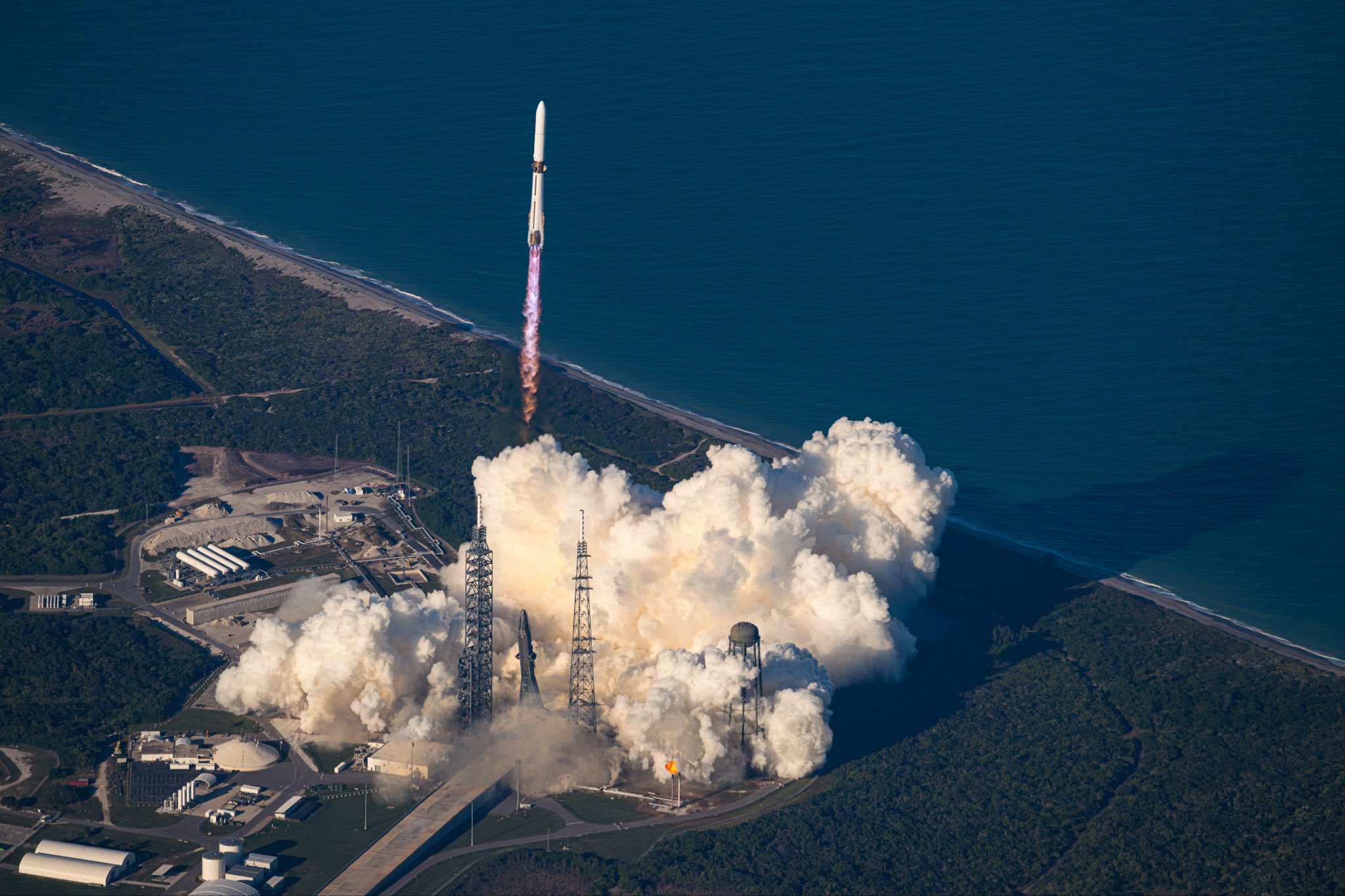
    Launch is targeted at 12:21 a.m. EST, Monday, Nov. 17 (9:21 p.m. PST, Sunday, Nov. 16) aboard a SpaceX Falcon 9 rocket from Space Launch Complex 4 East at Vandenberg Space Force Base in California.

    Watch coverage beginning at 11:30 p.m. EST (8:30 p.m. PST) on NASA+, Amazon Prime, and more. Learn how to watch NASA content through a variety of platforms, including social media.

    The Sentinel-6B mission continues a decades-long effort to monitor global sea level and ocean conditions using precise radar measurements from space. Since the early 1990s, satellites launched by NASA and domestic and international partners have collected precise sea level data. The launch of Sentinel-6B will extend this dataset out to nearly four decades.

    NASA’s mission coverage is as follows (all times Eastern and subject to change based on real-time operations):

    Saturday, Nov. 15

    4 p.m. – NASA Prelaunch Teleconference on International Ocean Tracking Mission

    • Karen St. Germain, director, Earth Science Division, NASA Headquarters in Washington
    • Pierrik Veuilleumier, Sentinel-6B project manager, ESA (European Space Agency)
    • Parag Vaze, Sentinel-6B project manager, NASA’s Jet Propulsion Laboratory in Pasadena, California
    • Tim Dunn, senior launch director, Launch Services Program, NASA’s Kennedy Space Center in Florida
    • Julianna Scheiman, director, NASA Science Missions, SpaceX
    • 1st Lt. William Harbin, launch weather officer, U.S. Air Force

    Audio of the teleconference will stream on the NASA Video YouTube channel.  

    Media interested in participating by phone must RSVP no later than two hours prior to the start of the call at: ksc-newsroom@mail.nasa.gov. A copy of NASA’s media accreditation policy is online.

    Sunday Nov. 16

    11:30 p.m. – Launch coverage begins on NASA+, Amazon Prime, and more.

    Audio-only coverage

    Audio-only of the launch coverage will be carried on the NASA “V” circuits, which may be accessed by dialing 321-867-1220 or -1240. On launch day, “mission audio” countdown activities without NASA+ launch commentary will be carried at 321-867-7135.

    NASA website launch coverage

    Launch day coverage of the mission will be available on the agency’s website. Coverage will include links to live streaming and blog updates beginning no earlier than 11 p.m. EST, Nov. 16, as the countdown milestones occur. Streaming video and photos of the launch will be accessible on demand shortly after liftoff. Follow countdown coverage on NASA’s Sentinel-6/Jason-CS blog.

    For questions about countdown coverage, contact the NASA Kennedy newsroom at: 321-867-2468.

    Attend launch virtually

    Members of the public can register to attend this launch virtually. NASA’s virtual guest program for this mission includes curated launch resources, notifications about related opportunities or changes, and a stamp for the NASA virtual guest passport following launch.

    Watch, engage on social media

    Let people know you’re watching the mission on X, Facebook, and Instagram by following and tagging these accounts:

    X: @NASA, @NASAKennedy, @NASAJPL, @NASAEarth

    Facebook: NASA, NASA Kennedy, NASA JPL, NASA Earth

    Instagram: @NASA, @NASAKennedy, @NASAJPL, @NASAEarth

    Sentinel-6B is the second of twin satellites in the Copernicus Sentinel-6/Jason-CS (Continuity of Service) mission, a collaboration among NASA, ESA, EUMETSAT (European Organisation for the Exploitation of Meteorological Satellites), and the National Oceanic and Atmospheric Administration (NOAA). The first satellite in the mission, Sentinel-6 Michael Freilich, launched in November 2020. The European Commission contributed funding support, while France’s space agency CNES (Centre National d’Études Spatiales) provided technical expertise. The mission also marks the first international involvement in Copernicus, the European Union’s Earth Observation Programme.

    For more information about these missions, visit:

    https://science.nasa.gov/mission/sentinel-6b/

    -end-

    Elizabeth Vlock
    NASA Headquarters, Washington
    202-358-1600
    elizabeth.a.vlock@nasa.gov

    Leejay Lockhart
    Kennedy Space Center, Fla.
    321-747-8310
    leejay.lockhart@nasa.gov

    Andrew Wang / Andrew Good
    Jet Propulsion Laboratory, Pasadena, Calif.
    626-379-6874 / 818-393-2433
    andrew.wang@jpl.nasa.gov / andrew.c.good@jpl.nasa.gov

  • Mapping Dark Matter

    Mapping Dark Matter

    This image shows two massive galaxy clusters. The vast number of galaxies and foreground stars in the image were captured by NASA’s James Webb Space Telescope in near-infrared light. Glowing, hot X-rays captured by NASA’s Chandra X-ray Observatory appear in pink. The blue represents the dark matter, which was precisely mapped by researchers with Webb’s detailed imaging.

  • Mapping Dark Matter

    Webb near-infrared data combined with Chandra X-ray data of the Bullet Cluster show many overlapping objects, including foreground stars, galaxies in galaxy clusters, and distorted background galaxies behind the galaxy clusters. The objects are all at various distances set against the black background of space. Most galaxies appear as tiny fuzzy ovals in white, orange, or red. A slightly larger, very bright, light blue spiral galaxy is at center. To its immediate left and right are two large bright pink splotches representing X-rays. The right pink area has a rounded nose facing right, where it is darker pink, and fades to the left as a triangular shape. This is referred to as the Bullet. To the far left and far right, next to the pink regions, are two blue regions representing dark matter mass. The left blue region is a large, long oval at an angle. The blue region at right is a far smaller oval.
    NASA, ESA, CSA, STScI, CXC

    This image released on June 30, 2025, combines data from NASA’s James Webb Space Telescope and NASA’s Chandra X-ray Observatory to visualize dark matter. Researchers used Webb’s observations to carefully measure the mass of the galaxy clusters shown here as well as the collective light emitted by stars that are no longer bound to individual galaxies.

    Learn more.

    Image credit: NASA, ESA, CSA, STScI, CXC

  • NASA Glenn Teams Win 2025 R&D 100 Awards 

    Graphic drawing showing the Earth and the Moon with satellites in space linked by lasers to circles showing planetary habitats, satellite dishes, and the space station.
    Artistic rendering of the High-Rate Delay Tolerant Networking protocol being used on the Laser Communications Relay Demonstration to transfer radio and optical communications between Earth and space.
    Credit: NASA 

    NASA’s Glenn Research Center in Cleveland has earned 2025 R&D 100 Awards for developing a system that delivers high-speed internet for space and co-inventing technology for a new class of soft magnetic nanocrystalline materials designed to operate at extreme temperatures. This brings NASA Glenn’s total to 130 R&D 100 Awards. 

    High-Rate Delay Tolerant Networking  

    NASA Glenn’s Daniel Raible and Rachel Dudukovich led their team of engineers to create High-Rate Delay Tolerant Networking  (HDTN), a cutting-edge software solution designed to revolutionize data streaming and communication in space. HDTN enables reliable, high-speed transmission of data between space and Earth — even under the extreme conditions of space — minimizing loss and system delay. 

    Eleven people stand next to one another inside an airplane hangar. Two small planes sit behind them. An American flag and a banner reading “Welcome! John H. Glenn Research Center at Lewis Field, Cleveland, Ohio” are visible behind the group.
    High-Rate Delay Tolerant Networking team photo, left to right: Tad Kollar, Eric Brace, Brian Tomko, José Lombay-González, Nadia Kortas, Daniel Raible, John Nowakowski, Shaun McKeehan, Ethan Schweinsberg, Prash Choksi, and Rachel Dudukovich.
    Credit: NASA/Jef Janis 

    “The HDTN software protocol allows faster, automated, and seamless data transfer between spacecraft, even across communication systems operating on different link speeds,” Raible said. “It’s up to 10 times faster than current delay-tolerant networking (DTN).” 

    This advanced technology has far-reaching implications beyond NASA. With its open-source code, HDTN paves the way for collaboration, innovation, and adoption across the rapidly expanding commercial space industry, offering near real-time communication capabilities. 

    Looking ahead, HDTN could form the foundation of a solar system-wide internet, supporting data exchange between Earth, spacecraft, and even future missions involving human travel to the Moon and Mars. 

    VulcanAlloy 

    In a project led by the University of Pittsburgh, researchers at NASA Glenn, including Nick Bruno, Grant Feichter, Vladimir Keylin, Alex Leary, and Ron Noebe, partnered with CorePower Magnetics to develop VulcanAlloy — a breakthrough soft magnetic nanocrystalline material. 

    Two packaged inductors with electrical windings sit on a large plate with wiring attached to the inductors and to the Glenn Extreme Environments Rig.
    NASA’s Glenn Research Center in Cleveland tested high-temperature inductors using VulcanAlloy technology in the NASA Glenn Extreme Environments Rig, which simulates the conditions on Venus’ surface, on May 13, 2025.
    Credit: NASA 

    VulcanAlloy, developed under NASA’s High Operating Temperature Technology Program using processing capability established by the Advanced Air Transport Technology project, operates above 500°C, far beyond the limits of conventional soft magnetic materials. Its nano-engineered structure maintains efficiency at high temperatures and frequencies. 

    With adjustable magnetic properties, it can replace multiple materials in components like inductors, transformers, motors, and sensors while reducing the need for bulky cooling systems — ideal for extreme environments. 

    Raytheon has tested VulcanAlloy cores, highlighting their potential in electrified aircraft, defense, and aerospace systems. 

    This innovation also promises major impact in electric vehicles, data centers, microgrids, and energy systems, where smaller, lighter, and more efficient components are key to advancing next-generation power electronics. 

    The R&D 100 Awards, a worldwide science and innovation competition, received entries from organizations around the world. Now in its 63rd year, this year’s judging panel included industry professionals from across the globe who evaluated breakthrough innovations in technology and science. 

  • A solar prominence hovers over the Sun


    Video:
    00:00:22

    The Sun is always mesmerising to watch, but Solar Orbiter captured a special treat on camera: a dark ‘prominence’ sticking out from the side of the Sun.   

    The dark-looking material is dense plasma (charged gas) trapped by the Sun’s complex magnetic field. It looks dark because it is cooler than its surroundings, being around 10 000 °C compared to the surrounding million-degree plasma.  

    When viewed against the background of space, the hovering plasma is referred to as a prominence. When viewed against the Sun’s surface, it is called a filament. (In this image you can see examples of both.) 

    Solar prominences and filaments extend for tens of thousands of kilometres, several times the diameter of Earth. They can last days or even months. This video shows one hour of footage, sped up to make movement more clearly visible.  

    Solar Orbiter recorded this video with its Extreme Ultraviolet Imager (EUI) instrument on 17 March 2025. At the time, the spacecraft was around 63 million km from the Sun, similar to planet Mercury. 

    Solar Orbiter is a space mission of international collaboration between ESA and NASA. The EUI instrument is led by the Royal Observatory of Belgium (ROB). 

    [Video description: Close-up video of the Sun, filling the left half of the view, its surface covered what looks like moving, glowing hairs accompanied by some short-lived bright arcs. Protruding to the right, in the centre of the video, is dark material that looks almost feathery, with thin streaks flowing both away from and towards the Sun.] 

  • Week in images: 10-14 November 2025

    3D-printed space metal under microscope

    Week in images: 10-14 November 2025

    Discover our week through the lens

  • Hubble Studies Star Ages in Colorful Galaxy

    2 min read

    Hubble Studies Star Ages in Colorful Galaxy

    An oval-shaped spiral galaxy. Only the center and lower half of the galaxy is in frame. Its center is primarily golden in color with a white glowing core, while its thick spiral arms are mostly blue, particularly at the outskirts; these colors merge in between. Dark lanes of dust swirl through the center, blocking some of the galaxy’s light. Stars and distant galaxies are visible around the edges on a black background.
    This NASA/ESA Hubble Space Telescope image features the spiral galaxy called NGC 6000.
    ESA/Hubble & NASA, A. Filippenko; Acknowledgment: M. H. Özsaraç

    Stars of all ages are on display in this NASA/ESA Hubble Space Telescope image of the sparkling spiral galaxy called NGC 6000, located 102 million light-years away in the constellation Scorpius.

    NGC 6000 has a glowing yellow center and glittering blue outskirts. These colors reflect differences in the average ages, masses, and temperatures of the galaxy’s stars. At the heart of the galaxy, the stars tend to be older and smaller. Less massive stars are cooler than more massive stars, and somewhat counterintuitively, cooler stars are redder, while hotter stars are bluer. Farther out along NGC 6000’s spiral arms, brilliant star clusters host young, massive stars that appear distinctly blue.

    Hubble collected the data for this image while surveying the sites of recent supernova explosions in nearby galaxies. NGC 6000 hosted two recent supernovae: SN 2007ch in 2007 and SN 2010as in 2010. Using Hubble’s sensitive detectors, researchers can discern the faint glow of supernovae years after the initial explosion. These observations help constrain the masses of supernovae progenitor stars and can indicate if they had any stellar companions.

    By zooming in to the right side of the galaxy’s disk in this image, you can see a set of four thin yellow and blue lines. These lines are an asteroid in our solar system that was drifting across Hubble’s field of view as it gazed at NGC 6000. The four lines are due to four different exposures recorded one after another with slight pauses in between. Image processors combined these four exposures to create the final image. The lines appear dashed with alternating colors because each exposure used a filter to collect very specific wavelengths of light, in this case around red and blue. Having these separate exposures of particular wavelengths is important to study and compare stars by their colors — but it also makes asteroid interlopers very obvious!

    Media Contact:

    Claire Andreoli (claire.andreoli@nasa.gov)
    NASA’s Goddard Space Flight CenterGreenbelt, MD

  • ESA pinpoints 3I/ATLAS’s path with data from Mars

    ExoMars Trace Gas Orbiter observes comet 3I/ATLAS – GIF

    Since comet 3I/ATLAS, the third known interstellar object, was discovered on 1 July 2025, astronomers worldwide have worked to predict its trajectory. ESA has now improved the comet’s predicted location by a factor of 10, thanks to the innovative use of observation data from our ExoMars Trace Gas Orbiter (TGO) spacecraft orbiting Mars.

  • Earth from Space: Prague

    This very high-resolution image captures the beautiful medieval core of the Czech capital, Prague.
    Image:
    This very high-resolution image captures the beautiful medieval core of the Czech capital, Prague.

  • NASA, Blue Origin Launch Two Spacecraft to Study Mars, Solar Wind

    NASA’s ESCAPADE (Escape and Plasma Acceleration and Dynamics Explorers) mission launched at 3:55 p.m. EST atop a Blue Origin New Glenn rocket at Launch Complex 36 at Cape Canaveral Space Force Station in Florida.
    Credit: Blue Origin

    A pair of NASA spacecraft ultimately destined for Mars will study how its magnetic environment is impacted by the Sun. The mission also will help the agency prepare for future human exploration of Mars.

    NASA’s ESCAPADE (Escape and Plasma Acceleration and Dynamics Explorers) spacecraft launched at 3:55 p.m. EST, Thursday, aboard a Blue Origin New Glenn rocket from Launch Complex 36 at Cape Canaveral Space Force Station in Florida.

    “Congratulations to Blue Origin, Rocket Lab, UC Berkeley, and all our partners on the successful launch of ESCAPADE. This heliophysics mission will help reveal how Mars became a desert planet, and how solar eruptions affect the Martian surface,” said acting NASA Administrator Sean Duffy. “Every launch of New Glenn provides data that will be essential when we launch MK-1 through Artemis. All this information will be critical to protect future NASA explorers and invaluable as we evaluate how to deliver on President Trump’s vision of planting the Stars and Stripes on Mars.”

    The twin spacecraft, built by Rocket Lab, will investigate how a never-ending, million-mile-per-hour stream of particles from the Sun, known as the solar wind, has gradually stripped away much of the Martian atmosphere, causing the planet to cool and its surface water to evaporate. The mission is led by the University of California, Berkeley.

    Ground controllers for the ESCAPADE mission established communications with both spacecraft by 10:35 p.m. EST.

    “The ESCAPADE mission is part of our strategy to understand Mars’ past and present so we can send the first astronauts there safely,” said Nicky Fox, associate administrator, Science Mission Directorate at NASA Headquarters in Washington. “Understanding Martian space weather is a top priority for future missions because it helps us protect systems, robots, and most importantly, humans, in extreme environments.”

    New Glenn also carried a space communications technology demonstration from Viasat Inc., supporting NASA’s efforts to commercialize next-generation satellite relay services for science missions. Funded by the agency’s Communications Services Project, the demonstration transmitted launch telemetry data from the rocket’s second stage to an operations center on Earth through Viasat’s geostationary satellite network.

    Blazing new trails

    Recent solar activity, which triggered widespread auroras on Earth, caused a slight delay in launch to prevent solar storms from negatively impacting post-launch spacecraft commissioning. When ESCAPADE arrives at Mars, it will study present-day effects of the solar wind and solar storms on the Red Planet in real time. This will provide insights about Martian space weather and help NASA better understand the conditions astronauts will face when they reach Mars.

    “The ESCAPADE spacecraft are now about to embark on a unique journey to Mars never traversed by any other mission,” said Alan Zide, ESCAPADE program executive at NASA Headquarters.

    Rather than heading directly to Mars, the twin spacecraft will first head to a location in space a million miles from Earth called Lagrange point 2. Right now, Earth and Mars are on opposite sides of the Sun, which makes it harder to travel from one planet to the other. In November 2026, when Earth and Mars are closely aligned in their orbits, the ESCAPADE spacecraft will loop back to Earth and use Earth’s gravity to slingshot themselves toward Mars.

    In the past, Mars missions have waited to launch during a brief window of time when Earth and Mars are aligned, which happens roughly every two years. However, with the type of trajectory ESCAPADE is using, future missions could launch nearly anytime and wait in space, queueing up for their interplanetary departure, until the two planets are in position.

    This original “Earth-proximity” or “loiter” orbit also will make ESCAPADE the first mission to ever pass through a distant region of Earth’s magnetotail, part of our planet’s magnetic field that gets stretched out away from the Sun by the solar wind.

    Studying Mars in stereo

    After a 10-month cruise, ESCAPADE is expected to arrive at Mars in September 2027, becoming the first coordinated dual-spacecraft mission to enter orbit around another planet.

    Over several months, the two spacecraft will arrange themselves in their initial science formation, in which the twin spacecraft will follow each other in the same “string-of-pearls” orbit, passing through the same areas in quick succession to investigate for the first time how space weather conditions vary on short timescales. This science campaign will begin in June 2028.

    Six months later, both spacecraft will shift into different orbits, with one traveling farther from Mars and the other staying closer to it. Planned to last for five months, this second formation aims to study the solar wind and Mars’ upper atmosphere simultaneously, allowing scientists to investigate how the planet responds to the solar wind in real time.

    In addition, ESCAPADE will provide more information about Mars’ ionosphere — a part of the upper atmosphere that future astronauts will rely on to send radio and navigation signals around the planet.

    The ESCAPADE mission is funded by NASA’s Heliophysics Division and is part of NASA’s Small Innovative Missions for Planetary Exploration program. NASA’s Goddard Space Flight Center in Greenbelt, Maryland, Embry-Riddle Aeronautical University, and Advanced Space support the mission. NASA’s Launch Services Program, based at Kennedy Space Center in Florida, secured the launch service with Blue Origin under the Venture-class Acquisition of Dedicated and Rideshare contract.

    To learn more about the ESCAPADE mission, visit:

    https://science.nasa.gov/mission/escapade/

    -end-

    Abbey Interrante
    Headquarters, Washington
    301-201-0124
    abbey.a.interrante@nasa.gov

    Leejay Lockhart
    Kennedy Space Center, Fla.
    321-747-8310
    leejay.lockhart@nasa.gov

  • Curiosity Blog, Sols 4702-4708: It’s Only Spooky Here on Earth Today!

    4 min read

    Curiosity Blog, Sols 4702-4708: It’s Only Spooky Here on Earth Today!

    A wide-angle, grayscale photo from the Mars surface shows mostly flat, medium gray, slightly rough terrain ahead of the rover, with a lighter-toned indentation in the round directly in front of it. In the distance at the upper right of the image, the ground becomes much more uneven and rocky, with a mesa rising from the ground on the horizon beyond that. Parts of the rover are visible, but dark and shadowed. Rover tracks are also visible, zig-zagging on the ground along the left edge of the image. The end of the rover’s robotic arm, with its fist-like collection of instruments, is poised just above the lighter-colored indentation in the ground, and its shadow runs on the ground back to the rover body at the bottom of the frame.
    NASA’s Mars rover Curiosity acquired this image at the start of the drilling activity at the “Valle de la Luna” site, “caught in the act” as this image was taken on Oct. 19, 2025. Curiosity used its Front Hazard Avoidance Camera (Front Hazcam) on Sol 4693, or Martian day 4,693 of the Mars Science Laboratory mission, at 01:54:37 UTC.
    NASA/JPL-Caltech

    By Susanne P. Schwenzer, Professor of Planetary Mineralogy at The Open University, U.K.

    Earth planning date: Friday, Oct. 31, 2025

    I am writing this blog and it’s still daytime — and I am looking forward to accompanying one of my favorite kids to trick-and-treating afterwards. That’s a new feeling for me because I am usually in the U.K., which means my Curiosity shifts start in the late afternoon when everyone else finishes working. But for now, I am in the U.S. (Houston, Texas), and it’s daytime, which is a lovely change, especially today as I don’t have to hide from trick-and-treaters’ interruptions but instead can give out all the candy they can possibly eat! Looking forward to that… but before, let’s see what Curiosity was up to this week!

    You’ll have seen the blog by my colleague Bill, “Searching for Answers at Monte Grande,” about our analysis of the “Valle de la Luna” sample with CheMin and SAM EGA. This week we were continuing the SAM analysis of the 44th drilled sample, which always takes a lot of power, so that leaves less room for other investigations. Hence, you might notice that there were fewer ChemCam and Mastcam activities. The rover also did not drive while sample is still in the turret ready for delivery of the next SAM activities. Curiosity has now completed the deliveries to CheMin and SAM, though, and the last action in Friday’s plan was to clean out the remaining sample from the drill in preparation for driving away here in Monday’s plan. 

    In Monday’s plan we’ll reposition the rover to get a very good look at the potential next drill targets on the ridge. We’ve been able to scout them already in previous images and have a few candidates, but decision-making will require images from Monday’s parking position, since we are currently parked in a hollow and cannot really see what’s up on the ridge.

    That said, being stationary has always been a golden opportunity for looking at wind action, and this week was no difference as Mastcam looked at the drill fines several times over the time we were stationary, to ascertain the safety for MAHLI to approach — and of course to use those images for atmospheric science, too. In addition, Mastcam took the opportunity to get comprehensive imaging of the entire area. There are several mosaics that document the near-field, for example at target “Nazareth.” In the mid- and far-field distances, Mastcam assembled a large mosaic on “Monte Grande” and “Ticaco” to document the different rocks in the surrounding ridge walls and wider afield. There are so many interesting textures and alteration features, alongside troughs and fractures, that the team will have a fun time analyzing them all in great detail individually, as well as their relationships to each other.  

    ChemCam has investigated the Valle de la Luna drill hole and tailings as per the usual cadence of post-drilling activities, and in addition investigated target Nazareth to understand how the block that Curiosity drilled might vary chemically. Another ChemCam target was “Pachica,” as the team observed many nodules in this target and we are interested in their chemical variability and “Palpana,” a more smooth block. Further investigations of the Valle de la Luna drill hole with ChemCam are targets “Anapia” and “Bandara” to further investigate the chemical diversity of the drill target block.

    ChemCam Remote Micro Imager (RMI) observations were also taken in the near-field and farther away. In the near-field, RMI images are documenting further details on the Valle de la Luna drill hole and its tailings, while further afield the Monte Grande Wall is one of the RMI targets alongside with other details in the boxwork ridges around us. On Friday, the RMI was pointed far uphill to continue imaging the yardang unit, which is one of our next goals in the longer term future.

    In addition to all the drill activities and rock investigations, the atmosphere received attention too. We have the usual cadence of environmental investigations, building our long-term pressure, temperature, and humidity record of Mars; and we observe the atmospheric opacity, dust-devil activities, and clouds. Of course, we are all looking forward to next week, when we will decide on the second drill target in this area, this time on the ridge. Let’s see what block will be looking best, both from a science and an engineering point of view – we’ve got a short list of candidates; the detailed images are for Monday’s plan. Meanwhile, we’ll enjoy trick-and-treating here on Earth and our weekends while Curiosity finishes the drill activities at Valle de la Luna.

    A rover sits on the hilly, orange Martian surface beneath a flat grey sky, surrounded by chunks of rock.
    NASA’s Mars rover Curiosity at the base of Mount Sharp
    NASA/JPL-Caltech/MSSS

    Details

    Last Updated

    Nov 13, 2025

    Related Terms

  • Curiosity Blog, Sols 4695-4701: Searching for Answers at Monte Grande

    3 min read

    Curiosity Blog, Sols 4695-4701: Searching for Answers at Monte Grande

    A color close-up photo of the Martian surface shows dry, flaky, tan-orange ground. At the image center is a hole cored into the ground, surrounded by material dug out from the hole, which looks like a mixture of soil and sharp flakes or shards of rock, and is slightly lighter-toned than the surrounding ground.
    NASA’s Mars rover Curiosity acquired this image of the “Valle de la Luna” drill hole using its Mast Camera (Mastcam) on Oct. 19, 2025 — Sol 4693, or Martian day 4,693 of the Mars Science Laboratory mission — at 02:04:29 UTC.
    NASA/JPL-Caltech/MSSS

    Written by William Farrand, Senior Research Scientist, Space Science Institute

    Earth planning date: Friday, Oct. 24, 2025

    Curiosity has successfully drilled its 44th hole on Mars, which is a major milestone in our investigation of the enigmatic “boxwork unit,” a region of resistant ridges surrounding pits or “hollows” of less-resistant rock. The drilling took place over the past weekend within the “Monte Grande” hollow at the “Valle de la Luna” target. 

    Rover planning this week consisted of ensuring that the granular drill tailings from Valle de la Luna were transferred to the SAM (Sample Analysis at Mars) and CheMin (X-ray diffraction) instruments, and analyzing the results. Results from these instruments, which will provide mineralogical and other compositional information, will be especially critical for determining how the boxwork features formed, since chemistry from the APXS and ChemCam instruments and reflectance spectra from ChemCam have revealed subtle, but not striking, differences between the rocks making up the ridges and those making up the hollows. Thus, a compositional explanation for the differences between the two terrain types has yet to be determined.

    While these internal studies of the Valle de la Luna samples were going on, remote sensing data were collected by Mastcam of a series of targets, as well as atmospheric remote sensing. Among the Mastcam studies being conducted is a photometry study, a kind of study usually only carried out during an extended stationary period, such as the current drill campaign. Photometry is the study of changes in the apparent reflected brightness of rocks and soils based on the illumination geometry (for example, whether the Sun is low on the horizon or high in the sky). During this photometry campaign, multiple images are collected of the same target regions at different times of day.

    In the final plan of the week, as part of the ongoing assessment of the Valle de la Luna sample, material will undergo an evolved gas analysis (EGA) in which the drilled sample is baked in an oven in SAM and volatile molecules including H2O, CO2, and SO2 are released and used to further aid in the characterization of the target materials. Mastcam observations will include further images collected as part of the photometry campaign. Also mosaics of the west wall of the Monte Grande hollow will be collected as well as several atmospheric measurements.

    Next week the rover will continue analyzing the drilled sample with more SAM experiments, and also analyze the tailings. The team is also starting to search for a suitable drilling location on a ridge as the next drilling site, in order to compare with the results from the Monte Grande hollow.

    A rover sits on the hilly, orange Martian surface beneath a flat grey sky, surrounded by chunks of rock.
    NASA’s Mars rover Curiosity at the base of Mount Sharp
    NASA/JPL-Caltech/MSSS

    Details

    Last Updated

    Nov 13, 2025

    Related Terms

  • Curiosity Blog, Sols 4689-4694: Drill in the Boxwork Unit is GO!

    3 min read

    Curiosity Blog, Sols 4689-4694: Drill in the Boxwork Unit is GO!

    A wide-angle, grayscale photo from the Mars surface shows mostly flat, medium gray, slightly rough terrain ahead of the rover, with a lighter-toned indentation in the round directly in front of it. In the distance at the upper right of the image, the ground becomes much more uneven and rocky, with a mesa rising from the ground on the horizon beyond that. Parts of the rover are visible, but dark and shadowed, around the sides and bottom of the image, including two of its wheels at the bottom of the frame.
    NASA’s Mars rover Curiosity acquired this image showing the “Valle de la Luna” block in the “Monte Grande” hollow, a location it targeted for drilling the weekend of Oct. 18-19, 2025. Curiosity captured the image with its Front Hazard Avoidance Camera (Front Hazcam) on Oct. 12, 2025 — Sol 4687, or Martian day 4,687 of the Mars Science Laboratory mission — at 23:11:12 UTC.
    NASA/JPL-Caltech

    Written by Catherine O’Connell-Cooper, APXS Payload Uplink/Downlink Lead, University of New Brunswick

    Earth planning date: Friday, Oct. 17, 2025

    Curiosity has been investigating the “boxwork unit” for several months now. Readers might remember we drilled at the edge of the boxwork at “Altadena,” back in June. Since then, we have driven just under a kilometer across the boxwork unit (about 0.6 miles) and now we are ready to acquire the next drill target, in an area where the structure is really well preserved.

    The boxwork structures are a series of ridges and hollows, so our plan is to drill within one of the hollows and then on one of the adjacent ridges. On Monday, we did our drill triage on “Valle de la Luna” within the hollow “Monte Grande” – a multi-instrument endeavor. We assessed the chemistry using APXS and ChemCam, to make sure it is within the expected range and not something completely different from the bedrock compositions we have been tracking. The rover planners (RPs) use a “pre-load” test, putting pressure on the bedrock surface to characterize how the rover arm and rock might behave during drilling. We take multiple images (including images before and after the pre-load test), using MAHLI and Mastcam to help the RPs assess the surface of the potential drill area.

    Finding a suitable place to drill in the hollows was a challenge, as the low point of each hollow (what we are most interested in) is often covered in sand or small pebbles, with just sparse bedrock peeking through, as you can see in the accompanying image. However, we got lucky here in Monte Grande. The chemistry shows that this rock is within our expected compositional range. The MAHLI images show a smoother surface in the center of the brushed area (where the drill will focus), and the before-and-after images indicated that the rock reacted well to the pre-load test. On Friday, the RPs and mission scientists pored over the data in a very intensive meeting called the “Target Acquisition Assessment Meeting,” or TAAM. We have drilled 43 holes on Mars now and it’s always nerve-wracking, waiting to see if the information we gathered during our initial contact science and preload give us a go-ahead. About midway through the planning day, we got the news that TAAM said yes to drilling here, so we will drill on the first sol of this weekend plan.

    If the drill is successful, we will have no contact science for at least a week, as the arm cannot be deployed during a drill campaign. Normally, as I’m APXS PUDL (responsible for uplinking new APXS targets and assessing downlink of previous targets), the idea of a week with no contact science would be disappointing to me — but not during a drill campaign! CheMin (Chemistry Mineralogy) and SAM (Sample Analysis at Mars) will use the drilled sample to give us extra depth of information, looking at mineralogy and composition in a way that is not possible for APXS and ChemCam.

    We can then use that drill data to help us interpret the APXS and ChemCam data and better understand the formation of these boxworks, especially if we can pair it with a suitable target on the ridges.

    In the meantime of course, we continue to monitor the atmosphere and environment around us. The Mastcam team are planning some amazing images from this site and ChemCam will continue to characterize the nearby bedrock and image the far-off hills. 

    A rover sits on the hilly, orange Martian surface beneath a flat grey sky, surrounded by chunks of rock.
    NASA’s Mars rover Curiosity at the base of Mount Sharp
    NASA/JPL-Caltech/MSSS

    Details

    Last Updated

    Nov 13, 2025

    Related Terms