Category: Kepler

http://www.nasa.gov/mission_pages/kepler/news/kepler-newsandfeatures-RSS.rss

  • NASA Demonstrates ‘Ultra-Cool’ Quantum Sensor for First Time in Space

    NASA’s Cold Atom Lab, shown where it’s installed aboard the International Space Station, recently demonstrated the use of a tool called an atom interferometer that can precisely measure gravity and other forces — and has many potential applications in space.
    NASA/JPL-Caltech

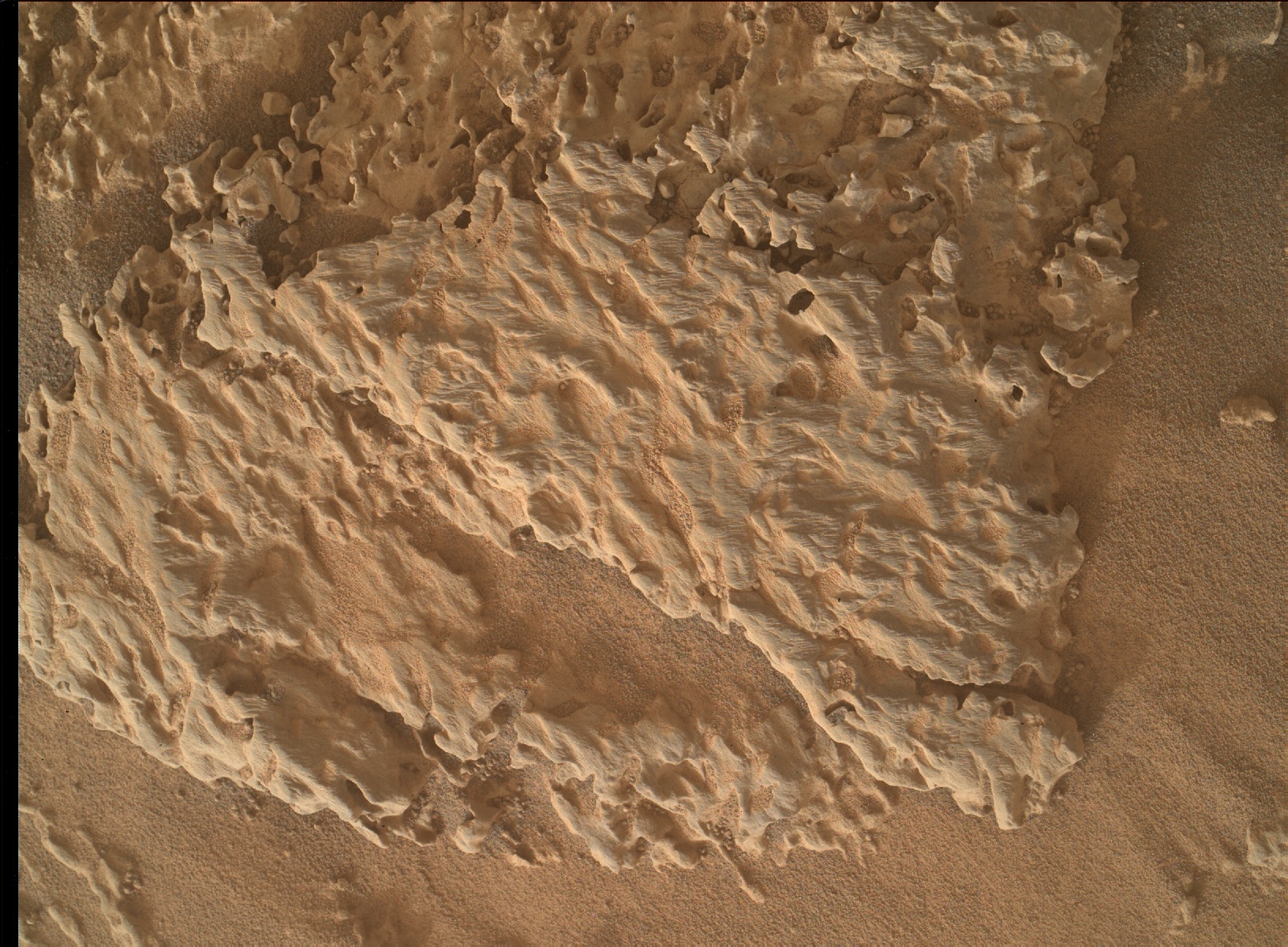
    Future space missions could use quantum technology to track water on Earth, explore the composition of moons and other planets, or probe mysterious cosmic phenomena.

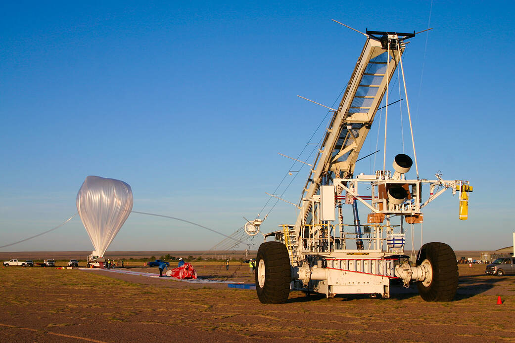
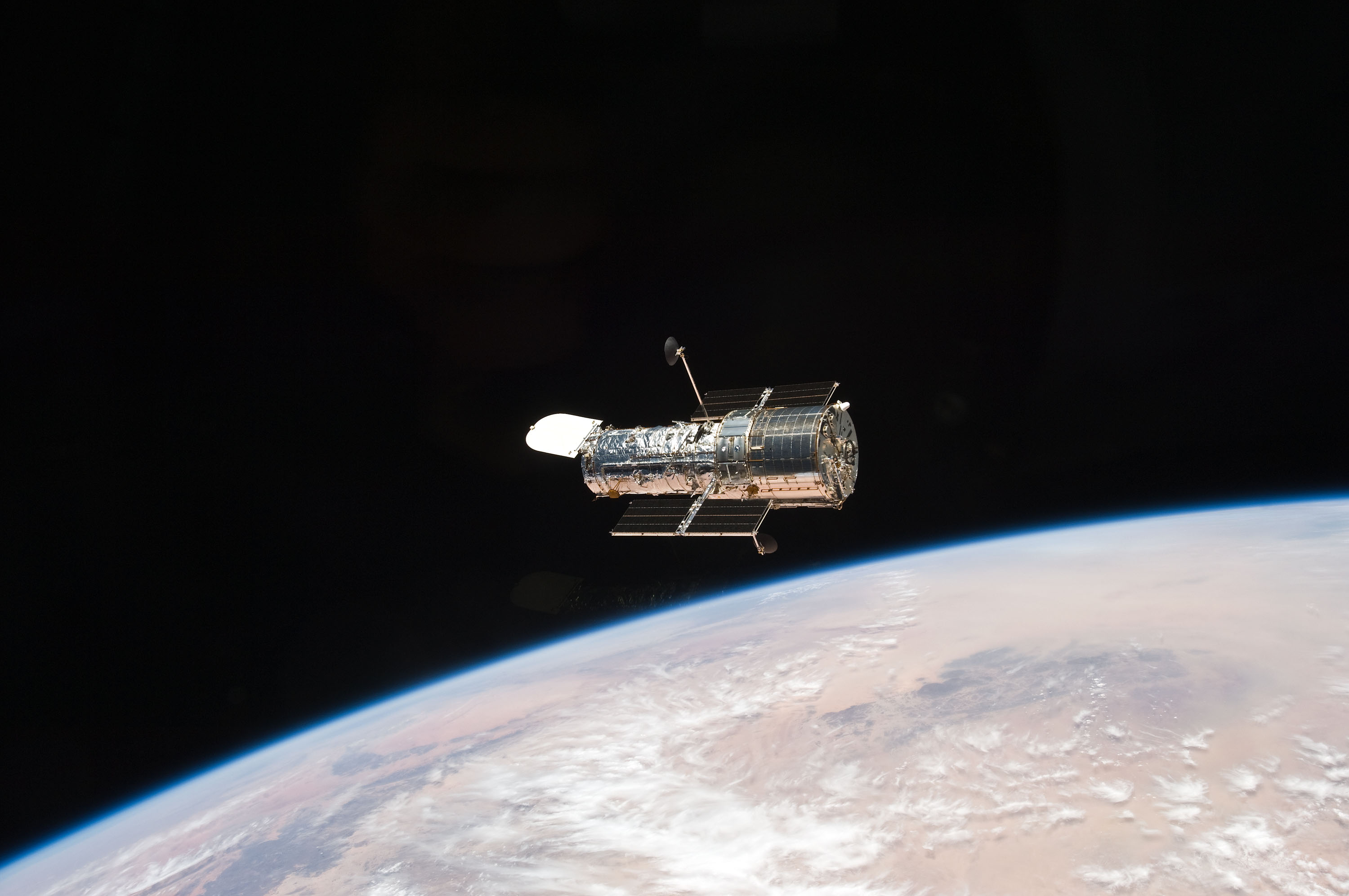
    NASA’s Cold Atom Lab, a first-of-its-kind facility aboard the International Space Station, has taken another step toward revolutionizing how quantum science can be used in space. Members of the science team measured subtle vibrations of the space station with one of the lab’s onboard tools — the first time ultra-cold atoms have been employed to detect changes in the surrounding environment in space.

    The study, which appeared in Nature Communications on Aug. 13, also reports the longest demonstration of the wave-like nature of atoms in freefall in space.

    The Cold Atom Lab science team made their measurements with a quantum tool called an atom interferometer, which can precisely measure gravity, magnetic fields, and other forces. Scientists and engineers on Earth use this tool to study the fundamental nature of gravity and advance technologies that aid aircraft and ship navigation. (Cell phones, transistors, and GPS are just a few other major technologies based on quantum science but do not involve atom interferometry.)

    Physicists have been eager to apply atom interferometry in space because the microgravity there allows longer measurement times and greater instrument sensitivity, but the exquisitely sensitive equipment has been considered too fragile to function for extended periods without hands-on assistance. The Cold Atom Lab, which is operated remotely from Earth, has now shown it’s possible.  

    “Reaching this milestone was incredibly challenging, and our success was not always a given,” said Jason Williams, the Cold Atom Lab project scientist at NASA’s Jet Propulsion Laboratory in Southern California. “It took dedication and a sense of adventure by the team to make this happen.”

    Power of Precision

    Space-based sensors that can measure gravity with high precision have a wide range of potential applications. For instance, they could reveal the composition of planets and moons in our solar system, because different materials have different densities that create subtle variations in gravity.

    This type of measurement is already being performed by the U.S.-German collaboration GRACE-FO (Gravity Recovery and Climate Experiment Follow-on), which detects slight changes in gravity to track the movement of water and ice on Earth. An atom interferometer could provide additional precision and stability, revealing more detail about surface mass changes.

    Precise measurements of gravity could also offer insights into the nature of dark matter and dark energy, two major cosmological mysteries. Dark matter is an invisible substance five times more common in the universe than the “regular” matter that composes planets, stars, and everything else we can see. Dark energy is the name given to the unknown driver of the universe’s accelerating expansion.

    “Atom interferometry could also be used to test Einstein’s theory of general relativity in new ways,” said University of Virginia professor Cass Sackett, a Cold Atom Lab principal investigator and co-author of the new study. “This is the basic theory explaining the large-scale structure of our universe, and we know that there are aspects of the theory that we don’t understand correctly. This technology may help us fill in those gaps and give us a more complete picture of the reality we inhabit.”

    A Portable Lab

    NASA’s Cold Atom Lab studies the quantum nature of atoms, the building blocks of our universe, in a place that is out of this world – the International Space Station. This animated explainer explores what quantum science is and why NASA wants to do it in space. Credit: NASA/JPL-Caltech

    About the size of a minifridge, the Cold Atom Lab launched to the space station in 2018 with the goal of advancing quantum science by putting a long-term facility in the microgravity environment of low Earth orbit. The lab cools atoms to almost absolute zero, or minus 459 degrees Fahrenheit (minus 273 degrees Celsius). At this temperature, some atoms can form a Bose-Einstein condensate, a state of matter in which all atoms essentially share the same quantum identity. As a result, some of the atoms’ typically microscopic quantum properties become macroscopic, making them easier to study.

    Quantum properties include sometimes acting like solid particles and sometimes like waves. Scientists don’t know how these building blocks of all matter can transition between such different physical behaviors, but they’re using quantum technology like what’s available on the Cold Atom Lab to seek answers.

    In microgravity, Bose-Einstein condensates can reach colder temperatures and exist for longer, giving scientists more opportunities to study them. The atom interferometer is among several tools in the facility enabling precision measurements by harnessing the quantum nature of atoms.

    Due to its wave-like behavior, a single atom can simultaneously travel two physically separate paths. If gravity or other forces are acting on those waves, scientists can measure that influence by observing how the waves recombine and interact.

    “I expect that space-based atom interferometry will lead to exciting new discoveries and fantastic quantum technologies impacting everyday life, and will transport us into a quantum future,” said Nick Bigelow, a professor at University of Rochester in New York and Cold Atom Lab principal investigator for a consortium of U.S. and German scientists who co-authored the study.

    More About the Mission

    A division of Caltech in Pasadena, JPL designed and built Cold Atom Lab, which is sponsored by the Biological and Physical Sciences (BPS) division of NASA’s Science Mission Directorate at the agency’s headquarters in Washington. BPS pioneers scientific discovery and enables exploration by using space environments to conduct investigations that are not possible on Earth. Studying biological and physical phenomena under extreme conditions allows researchers to advance the fundamental scientific knowledge required to go farther and stay longer in space, while also benefitting life on Earth. 

    To learn more about Cold Atom Lab, visit:

    https://coldatomlab.jpl.nasa.gov/

    News Media Contact

    Calla Cofield
    Jet Propulsion Laboratory, Pasadena, Calif.
    626-808-2469
    calla.e.cofield@jpl.nasa.gov

    2024-106

  • NASA to Launch 8 Scientific Balloons From New Mexico

    4 min read

    Preparations for Next Moonwalk Simulations Underway (and Underwater)

    A crane holds a science instrument as a large scientific balloon, tethered to the ground, inflates before liftoff in New Mexico.
    A scientific balloon is inflated for the Salter Test Flight before being released during NASA’s 2023 fall balloon campaign. The test flight returns for the 2024 campaign in Fort Sumner, New Mexico, carrying several smaller payloads.
    NASA/Andrew Hynous

    NASA’s Scientific Balloon Program has kicked off its annual fall balloon campaign at the agency’s balloon launch facility in Fort Sumner, New Mexico. Eight balloon flights carrying scientific experiments and technology demonstrations are scheduled to launch from mid-August through mid-October.

    The flights will support 16 missions, including investigations in the fields of astrophysics, heliophysics, and atmospheric research.

    “The annual Fort Sumner campaign is the cornerstone of the NASA Balloon Program operations,” said Andrew Hamilton, acting chief of NASA’s Balloon Program Office. “Not only are we launching a large number of missions, but these flights set the foundation for follow-on missions from our long-duration launch facilities in Antarctica, New Zealand, and Sweden. The Fort Sumner campaign is also a strong focus for our student-based payloads and is an excellent training opportunity for our up-and-coming scientists and engineers.”

    Returning to the fall lineup is the EXCITE (Exoplanet Climate Infrared Telescope) mission led by Peter Nagler, principal investigator, NASA’s Goddard Space Flight Center in Greenbelt, Maryland. EXCITE features an astronomical telescope developed to study the atmospheric properties of Jupiter-type exoplanets from near space. EXCITE’s launch was delayed during the 2023 campaign due to weather conditions.

    “The whole EXCITE team is looking forward to our upcoming field campaign and launch opportunity from Fort Sumner,” said Nagler. “We’re bringing a more capable instrument than we did last year and are excited to prove EXCITE from North America before we bring it to the Antarctic for our future long-duration science flight.”

    Some additional missions scheduled to launch include:

    • Salter Test Flight: The test flight aims to verify system design and support several smaller payloads on the flight called piggyback missions.
    • HASP 1.0 (High-Altitude Student Platform): This platform supports up to 12 student payloads and assists in training the next generation of aerospace scientists and engineers. It is designed to flight test compact satellites, prototypes, and other small payloads.
    • HASP 2.0 (High-Altitude Student Platform 2): This engineering test flight of the upgraded gondola and systems for the HASP program aims to double the carrying capability of student payloads.
    • DR-TES (mini-Dilution Refrigerator and a Transition Edge Sensor): This flight will test a cooling system and a gamma-ray detector in a near-space environment.
    • TIM Test Flight (Terahertz Intensity Mapper): This experiment will study galaxy evolution and the history of cosmic star formation.
    • THAI-SPICE (Testbed for High-Acuity Imaging ­­– ­­­Stable Photometry and Image-motion Compensation Experiment): The goal of this project is to build and demonstrate a fine-pointing system for stratospheric payloads with balloon-borne telescopes. 
    • TinMan (Thermalized Neutron Measurement Experiment): This hand-launch mission features a 60-pound payload designed to help better understand how thermal neutrons may affect aircraft electronics.

    An additional eight piggyback missions will ride along on flights to support science and technology development. Three of these piggyback missions are technology demonstrations led by the balloon program team at NASA’s Wallops Flight Facility in Virginia. Their common goal is to enhance the capabilities of NASA balloon missions. CASBa (Comprehensive Avionics System for Balloons) aims to upgrade the flight control systems for NASA balloon missions. DINGO (Dynamics INstrumentation for GOndolas) and SPARROW-5 (Sensor Package for Attitude, Rotation, and Relative Observable Winds – Five) are technology maturation projects designed to provide new sensing capabilities to NASA balloon missions.

    Zero-pressure balloons, used in this campaign, are in thermal equilibrium with their surroundings as they fly. They maintain a zero-pressure differential with ducts that allow gas to escape to prevent an increase in pressure from inside the balloons as they rise above Earth’s surface. This zero-pressure design makes the balloons very robust and well-suited for short, domestic flights, such as those in this campaign. The loss of lift gas during the day-to-night cycle affects the balloon’s altitude after repeated day-to-night cycles; however, this can be overcome by launching from the polar regions, such as Sweden or Antarctica, where the Sun does not set on the balloon in the summer.

    To follow the missions in the 2024 Fort Sumner fall campaign, visit NASA’s Columbia Scientific Balloon Facility website for real-time updates of balloons’ altitudes and locations during flight.

    NASA’s Wallops Flight Facility in Virginia manages the agency’s scientific balloon flight program with 10 to 15 flights each year from launch sites worldwide. Peraton, which operates NASA’s Columbia Scientific Balloon Facility (CSBF) in Palestine, Texas, provides mission planning, engineering services, and field operations for NASA’s Scientific Balloon Program. The CSBF team has launched more than 1,700 scientific balloons over some 40 years of operations. NASA’s balloons are fabricated by Aerostar. The NASA Scientific Balloon Program is funded by the Science Mission Directorate’s Astrophysics Division at NASA Headquarters in Washington. 

    For more information on NASA’s Scientific Balloon Program, visit: https://www.nasa.gov/scientificballoons 

    By Olivia Littleton
    NASA’s Wallops Flight Facility, Wallops Island, Va.

    Details

    Last Updated

    Aug 09, 2024

    Editor
    Olivia F. Littleton
    Contact
    Olivia F. Littleton
    Location
    Wallops Flight Facility

  • Low Leakage Cryogenic Disconnects for Fuel Transfer and Long-Term Storage

    To enable deep space missions, the capability to transfer and store cryogenic fuels (typically liquid hydrogen, methane, and oxygen) without significant leakage over long duration missions is critical. NASA has been actively developing zero boil-off cryocooler technology to reduce storage losses. Another source of fuel loss is from leakage at the fuel disconnect used for in-space refueling. Current designs use fluoroelastomer seals which are excellent for applications such as natural gas but are susceptible to embrittlement at the lower temperatures required for liquid hydrogen. In addition, the high contact forces needed to reduce leakage can cause cracking of the seals. NASA is seeking potential low or zero leakage cryogenic disconnect seal designs that could be fabricated and tested.

    Award: $6,000 in total prizes

    Open Date: July 31, 2024

    Close Date: September 25, 2024

    For more information, visit: https://grabcad.com/challenges/low-leakage-cryogenic-disconnects-for-fuel-transfer-and-long-term-storage

  • Earth to Gateway: Electric Field Tests Enhance Lunar Communication

    2 min read

    Preparations for Next Moonwalk Simulations Underway (and Underwater)

    Left: An artist's rendering of Gateway space station's Power and Propulsion Element (PPE) and Habitation and Logistics Outpost (HALO) in lunar orbit. The image showcases the space station's intricate design, including solar panels, antennas, and docking ports against a starry backdrop. Right: A photograph of an antenna being tested in an anechoic chamber at NASA’s Johnson Space Center. The antenna, mounted on a stand, is positioned in a room lined with blue, sound-absorbing foam.
    An artist’s rendering of NASA’s Gateway space station in lunar orbit, featuring the Power and Propulsion Element (PPE) and Habitation and Logistics Outpost (HALO), left, and a photograph of an antenna undergoing testing in an anechoic chamber at NASA’s Johnson Space Center, right.
    NASA/Robert Markowitz

    Engineers at NASA’s Johnson Space Center recently began electric field testing on representative communications hardware for Gateway, humanity’s first space station to orbit the Moon.

    An orbiting laboratory for deep space science and a staging ground for lunar exploration, Gateway will help NASA and its international partners establish a sustained human presence on and around the Moon in preparation for the next giant leap – human exploration of Mars.

    High-gain antennas are an important component of Gateway’s communication and tracking system that connects operations across the vast distances of the lunar South Pole region, to Gateway in orbit around the Moon, to Earth, and back again.  

    NASA is conducting rigorous testing on the electric field levels radiated by the antennas to ensure safe and efficient communication and to avoid any interference with Gateway’s crew and equipment. By validating simulation models to accurately predict electric field levels, NASA can establish precise safety zones around the K/Ka-band parabolic reflector antennas to protect astronauts and hardware without sacrificing high-rate communications.

    During the meticulous testing process, engineers use electric field and waveguide probes, which measure the strength and quality of electromagnetic signals, to scan the near fields of a representative high-gain antenna. Robotic arms and optical tracking systems provide the precise measurements needed for model validation. The testing is being conducted in an anechoic chamber, a specialized room that provides a controlled environment for measurements of electromagnetic waves.

    “We are sharpening our pencil in conducting model validation measurements – ensuring high accuracy in the analysis of electric fields radiated by the high-gain antennas on Gateway,” said Timothy Kennedy, one of the NASA engineers overseeing the tests. “This enables reduced margins on antenna masking needed to protect equipment and crew, while maximizing communication coverage.”

    Findings are expected to enhance NASA’s understanding of the electric field levels emitted by Gateway’s antennas and inform critical decisions for operating them safely during Artemis missions, ensuring that Gateway is a safe home for astronauts around the Moon.

    Details

    Last Updated

    Jul 29, 2024

    Editor
    Briana R. Zamora
    Contact
    Briana R. Zamora

  • Hubble Images a Classic Spiral 

    2 min read

    Hubble Images a Classic Spiral 

    A spiral galaxy with three prominent arms wrapping around it. The galaxy holds plenty of extra gas and dark dust between the arms. There are shining blue points throughout the arms and some patches of gas out beyond the galaxy’s edge, where stars are forming. The center of the galaxy also shines brightly. It is on a dark background where some small orange dots mark distant galaxies.
    This NASA/ESA Hubble Space Telescope image features the majestic spiral galaxy NGC 3430.
    ESA/Hubble & NASA, C. Kilpatrick

    This NASA/ESA Hubble Space Telescope image treats viewers to a wonderfully detailed snapshot of the spiral galaxy NGC 3430 that lies 100 million light-years from Earth in the constellation Leo Minor. Several other galaxies, located relatively nearby to this one, are just beyond the frame of this image; one is close enough that gravitational interaction is driving some star formation in NGC 3430 — visible as bright-blue patches near to but outside of the galaxy’s main spiral structure. This fine example of a galactic spiral holds a bright core from which a pinwheel array of arms appears to radiate outward. Dark dust lanes and bright star-forming regions help define these spiral arms.

    NGC 3430’s distinct shape may be one reason why astronomer Edwin Hubble used to it to help define his classification of galaxies. Namesake of the Hubble Space Telescope, Edwin Hubble authored a paper in 1926 that outlined the classification of some four hundred galaxies by their appearance — as either spiral, barred spiral, lenticular, elliptical, or irregular. This straightforward typology proved extremely influential, and the detailed schemes astronomers use today are still based on Edwin Hubble’s work. NGC 3430 itself is a spiral lacking a central bar with open, clearly defined arms — classified today as an SAc galaxy.

    Astronomer Edwin Hubble pioneered the study of galaxies based simply on their appearance. This “Field Guide” outlines Hubble’s classification scheme using images from his namesake telescope. Credit: NASA’s Goddard Space Flight Center; Lead Producer: Miranda Chabot; Lead Writer: Andrea Gianopoulos

    Explore More

    Media Contact:

    Claire Andreoli
    NASA’s Goddard Space Flight CenterGreenbelt, MD
    claire.andreoli@nasa.gov

  • Sols 4226-4228: A Powerful Balancing Act

    2 min read

    Sols 4226-4228: A Powerful Balancing Act

    NASA’s Mars rover Curiosity acquired this image about 10 inches (25 centimeters) from the “Loch Leven” target using its Mars Hand Lens Imager (MAHLI) close-up camera, located on the turret at the end of the rover’s robotic arm, in daylight on June 16, 2024, sol 4216 (or Martian day 4,216) of the Mars Science Laboratory Mission, at 05:12:12 UTC.

    Earth planning date: Tuesday, June 25, 2024

    As documented in a previous blog last week, we continue to juggle power constraints as we focus on analyzing our newest drilled sample on Mars: “Mammoth Lakes 2.” Today, the star of the show is a planned dropoff to SAM (Sample Analysis at Mars instrument suite) and evolved gas analysis of the drill sample. This activity requires significant power so the team had to be judicious in planning other science observations and balancing the power needs of the different activities.

    While the team eagerly awaits the outcome of the SAM and CheMin (Chemistry and Mineralogy X-Ray Diffraction instrument) analyses of Mammoth Lakes 2, we continue to acquire other observations in this fascinating area that will assist in our interpretations of the mineralogical data. ChemCam (the Chemistry and Camera instrument) will fire its laser at the “Loch Leven” target to get more chemical data on a target that was previously analyzed by APXS (the Alpha Particle X-Ray Spectrometer). “Loch Leven” is an example of gray material that rims the Mammoth Lakes drill block. The remote imaging capabilities of the ChemCam instrument will also be utilized to acquire a mosaic of a nearby area with interesting lighter- and darker-toned patches within the exposed rocks. Mastcam (Mast camera, for color stills and video) will document the ChemCam “Loch Leven” target and image the Mammoth Lakes 2 drill hole and surrounding fines to monitor any changes resulting from wind. We will also acquire extensions to two previous Mastcam mosaics: “Camp Four” and “Falls Ridge.”

    To continue monitoring atmospheric conditions, the team also planned a Navcam (grayscale, stereoscopic Navigation cameras) large dust devil survey and Mastcam tau observation, an overhead image to measure dust in the atmosphere above Curiosity. Standard DAN (Dynamic Albedo of Neutrons instrument), REMS (Rover Environmental Monitoring Station), and RAD (Radiation Assessment Detector) activities round out the plan.

    Written by Lucy Thompson, Planetary Geologist at University of New Brunswick

    Details

    Last Updated

    Jun 27, 2024

    Related Terms

  • Interesting Rock Textures Galore at Bright Angel

    2 min read

    Interesting Rock Textures Galore at Bright Angel

    Rocky, pale-orange-colored terrain on Mars. What looks like fine-gran sand is interspersed with many jagged rocks pointing out of the ground; a few of the rocks are gray, not orange.
    NASA’s Mars Perseverance rover acquired this image using its Right Mastcam-Z camera. Mastcam-Z is a pair of cameras located high on the rover’s mast. This image was acquired on June 10, 2024 (Sol 1175, or Martian day 1,175 of the Mars 2020 mission) at the local mean solar time of 14:04:57.

    Upon the rover’s arrival at Bright Angel, it was so exciting to see all the interesting features in the rocks of this interval! In particular, these rocks contain an abundance of veins and nodules. Veins are linear features containing mineral crystals that often form thin plates or sheets that cut through the rocks and across other veins. Veins are often more resistant to erosion than the rocks they are found in so they stand out in raised relief. Nodules are small, rounded protrusions in the rocks. Nodules are often sites of mineral formation distinct from the surrounding rock.

    Veins and nodules form when water flows through a rock, and minerals crystallize from this water in cracks and empty spaces within the rock. Features like this were previously observed by Perseverance during its exploration of the sedimentary rocks of the western fan, particularly during the “Fan Front Campaign” at Hogwallow Flats. However, these features have been sparse in the margin unit. The omnipresence of veins and nodules in the rocks of Bright Angel is truly striking. We hope to get more data on these interesting features over the next few weeks because they may signify intense water-rock interaction at this site!

    Written by Hemani Kalucha, Ph.D. student at Caltech

    Details

    Last Updated

    Jun 27, 2024

    Related Terms

  • Sols 4214–4215: The Best Laid Plans…

    3 min read

    Sols 4214–4215: The Best Laid Plans…

    MAHLI image of “Mammoth Lakes,” which we had hoped would become our 41st drill hole after today’s plan.
    NASA/JPL-Caltech/MSSS

    Earth planning date: Wednesday, June 12, 2024

    Planning today was defined by the decision about whether or not to drill at “Mammoth Lakes,” the potential drill target that we selected on Monday. This decision is made based on the answer to two questions. First, does this location meet our science objectives? On Monday, we undertook some exploratory contact science (primarily with APXS) to answer this question by determining the likely elemental composition of Mammoth Lakes. Second, is it safe to drill here? Monday’s plan also included a “preload test” to determine the safety of drilling by using the arm to place some pressure on Mammoth Lakes. We do these activities to measure the forces we expect on the arm while drilling and to see if the rock is stable enough to drill into. Although the APXS data indicated that this location meets our science objectives, the preload test was unsuccessful. Consequently, we had to pull the drill activities from the plan. 

    The drill activities had been scheduled to consume the entire first sol of this two sol plan. Unfortunately, the assessment of the preload data came too late to properly pivot from a drilling sol, so we were unable to plan any observations to replace the pulled drill activities. This means that Curiosity gets to take an unplanned vacation with just REMS and RAD observations on the first sol.

    The second sol looks more like a typical plan, though we had to pull a number of drill-related activities here as well, so it’s a bit emptier than usual. We begin with a Mastcam tau observation looking at the amount of dust in the atmosphere, then move on to a set of Mastcam and Navcam photometry images. These photometry observations take several images of the ground near the rover at different times of day to help us understand how sunlight scatters off of the rocks around us. We take a quick break from science to let the rover communicate with Earth through the Mars Relay Network, then get right back to work with ChemCam. LIBS will be used on the target “Golden Trout Lake,” then we’ll get an RMI mosaic of an area about 15 metres away from the rover.

    Once ChemCam is done, we’ll have our second set of Mastcam and Navcam photometry observations to complement those taken earlier in the sol. We’ll then take Mastcam images of the Golden Trout Lake LIBS target, one of ChemCam’s AEGIS targets, and some light-toned rocks at “Camp Four.” Mastcam will also be monitoring “Walker Lake,” a nearby patch of sand, to see how the wind is moving the sand around.

    Today’s plan wraps up with a collection of environmental science activities, including a dust devil survey, suprahorizon movie, and a line-of-sight mosaic of the north crater rim, as well as our usual suite of REMS, DAN, and RAD observations.

    Despite the challenges of today, we’re not giving up just yet. This isn’t our first failed preload test, so the team is now looking for somewhere else in this area to drill. Hopefully we won’t have the same difficulties as when we were trying to drill at the Marker Band, but nobody ever said that drilling a hole in a rock from over 270 million kilometres away was easy!

    Written by Conor Hayes, Graduate Student at York University

    Details

    Last Updated

    Jun 13, 2024

    Related Terms

  • Sols 4212-4214: Gearing up to Drill!

    2 min read

    Sols 4212-4214: Gearing up to Drill!

    The Voyager project is managed for NASA by the Jet Propulsion Laboratory, Pasadena, Calif. A black-and-white photo on the Martian surface is dominated in the lower half of the frame by a crosspiece of the Curiosity rover bearing its name, spelled in all-capitalized, white-outlined letters next to a white line drawing of the rover. The ground in front of it, visible from the middle to the upper part of the frame, appears as uneven, cracked slabs, with scattered small rocks beyond those.
    This image was taken by Left Navigation Camera onboard NASA’s Mars rover Curiosity on Sol 4210 and captures the block which hosts our potential drill target, “Mammoth Lakes.”
    NASA/JPL-Caltech

    Earth planning date: Monday, June 11, 2024

    Curiosity is gearing up to drill! Last week, it encountered a rock with unusual coloration and texture that was just out of reach (you can read about it and see pictures here and here). So that Curiosity could learn more about the geology around these rocks, it “bumped” – completing a 0.7-meter drive (2.3 feet) – to reach a nearby rock that’s big enough to drill! After many discussions over the past week with engineers, geologists, chemists, and more, the team has confirmed this target will be our next potential drill target (pictured). We’ve chosen the target name “Mammoth Lakes,” named for a town in California’s Sierra Nevada mountains with basalt columns, hot springs, and waterfalls.

    Today, as the Keeper of the Plan for the Geology and Mineralogy theme group, I was busy recording all the necessary observations into the plan as we prepare to drill. In the first sol, we’ll start with some essential preparatory activities. We’ll use our Dust Removal Tool (DRT) to clean the surface, take detailed images with the Mars Hand Lens Imager (MAHLI) to capture the sedimentary textures, and analyze the composition with the Alpha Particle X-ray Spectrometer (APXS). These steps are crucial to understand the site’s potential before we commit to drilling.

    The second sol is where things heat up. ChemCam will fire up its Laser Induced Breakdown Spectroscopy (LIBS) to zap the rock and analyze its makeup. We then follow up this activity with imaging the surrounding area to help us understand the context of “Mammoth Lakes.” Mastcam will devote half an hour to capture a mammoth mosaic of the area, showing a potential contact in Gediz Vallis ridge which is marked by a transition from white stones into a coarser material. To top it off, we’ll use the ChemCam’s Remote Micro-Imager (RMI) to get some high-res shots of the sedimentary textures and structures within the surrounding rocks to help us understand the depositional environment when they formed.

    Even with all these activities, the environmental science theme group managed to fit in some dust monitoring. Here’s hoping all goes well, and we can make “Mammoth Lakes” our 41st drill hole!

    Written by Amelie Roberts, Ph.D. candidate at Imperial College London

    Details

    Last Updated

    Jun 12, 2024

    Related Terms

  • NASA Ames Hosts National Wildfire Coordinating Group

    4 min read

    Preparations for Next Moonwalk Simulations Underway (and Underwater)

    Executive board members from the NWCG stand in front of giant turbines in the National Full Scale Aerodynamic Complex during their visit to Ames Research Center on May 23, 2024.
    NWCG Executive Board members stand in front of giant turbines in the National Full Scale Aerodynamic Complex during their visit to Ames Research Center on May 23, 2024.
    USAF/Patrick Goulding

    On May 21-23, 2024, the National Wildfire Coordinating Group (NWCG) visited NASA Ames Research Center, with participants representing 13 agencies and organizations. NWCG is a cooperative group focused on providing national leadership to enable interoperable wildland fire operations among federal, state, local, Tribal, and territorial partners. NASA became an associate member of NWCG in February 2024, with the goal of increasing collaboration across agencies and leveraging NASA data, technology, and innovation for nation-wide efforts in wildland fire management.    

    NASA’s Approach to Wildland Fire Management

    Across the agency, NASA’s approach to wildland fire management involves the application of research and technology before, during, and after a fire, in order to help ecosystems, animals, and human communities thrive. At Ames, two examples of these capabilities are the project office for FireSense and the Advanced Capabilities for Emergency Response Operations (ACERO) project. 

    Wildland fire solutions are a major theme within NASA’s Earth Action strategy. FireSense is part of this NASA-wide approach to wildland fire management, working with operational agencies and partners to measure pre-fire fuels conditions, active fire behavior, post-fire impacts and threats, and provide air quality forecasting. ACERO develops cutting-edge technology to remotely identify, monitor, and suppress wildland fire through the use of uncrewed aircraft.  

    Team members from both projects participated in the NWCG visit, and are represented in NWCG; NASA’s involvement is supported by Parimal Kopardekar (Director of the NASA Aeronautics Research Institute and the Advanced Air Mobility (AAM) Mission Integration Office) and Michael Falkowski (NASA Wildland Fires and FireSense Program Manager). Together, they represent NASA’s cross-mission directorate approach to managing wildland fire across the fire life cycle.  

    NASA Ames’ Involvement in NWCG: Data and Human Performance Characteristics

    By hosting NWCG’s annual offsite Executive Board meeting, Ames personnel were able to connect board members with NASA subject matter experts and project managers, provide tours of Ames facilities relevant to wildland fire management, and discuss NASA’s core capabilities and how they can augment the NWCG’s nation-wide fire management efforts. Specifically, NASA’s data capabilities and human performance characteristics studies were at the forefront of the day’s events.  

    On the data front, conversation centered around how to collectively tackle data continuity, storage, and accessibility. Large-scale computing resources are increasingly essential to store, manage, and incorporate data relevant to wildland fire management. With more advanced sensors on crewed aircraft, uncrewed aircraft, and satellites, addressing data continuity, storage, and accessibility are an essential piece of supporting wildland fire managers. 

    Ian Brosnan, Principal Investigator for NASA Earth eXchange (NEX), provided details about the NEX supercomputing and data analytics platform at Ames. The platform serves as a tool to increase availability of data from NASA missions and other sources, models, analysis tools, and research results, and the team uses this platform to investigate questions relevant to the increasing impact of wildland fire. For instance, their work uses machine learning and complex data integration to link air quality emissions and fire behavior, in order to detect wildfire ignition and spread. 

    The other focus of the Ames tour was NASA simulations and studies surrounding human performance characteristics, which refers to the human component of wildland fire management – such as managing fatigue in the field. Supporting the workforce is a primary goal for improving overall response to wildland fire management, as highlighted in the Wildfire Mitigation and Management Commission Report.  

    On this visit, NWCG members were able to meet with Jessica Nowinski, Division Chief of the Human Systems Integration Division, for a Human Factors overview, followed by a presentation by Immanuel Barshi on astronaut and pilot training, and a presentation by Cassie Hilditch on fatigue studies. NWCG Executive Board members were also able to tour the Airspace Operations Laboratory, with a particular focus on drones. The visit concluded with a tour of the National Full Scale Aerodynamic Complex, colloquially referred to as the Wind Tunnel.   

    The NWCG tour concluded in the National Full Scale Aerodynamic Complex; the group provides a sense of scale for just how massive the turbines are that pull air into the 120-foot wind tunnel.
    The NWCG tour concluded in the National Full Scale Aerodynamic Complex; the group provides a sense of scale for just how massive the turbines are that pull air into the 120-foot wind tunnel.
    Patrick Goulding/USAF

    The Future of NASA and NWCG

    NWCG’s strength is fostering partnership, and many discussions over the three-day visit leveraged complementary strengths between the agencies. Bringing together research specialties, technology innovation, existing programs and campaigns, and subject expertise makes the national approach to wildland fire management more unified, efficient, and effective.  

    Looking forward, NASA’s involvement with NWCG will continue to produce partnership opportunities and further the national wildland fire management goals. NASA personnel are connecting with NWCG committees – including Data Management, Geospatial, Aviation and Risk Management – and will continue to support NWCG objectives by connecting subject matter experts across the agency with NWCG subject matter experts in the field.  

    About the Author

    Milan Loiacono

    Milan Loiacono

    Science Communication Specialist

    Milan Loiacono is a science communication specialist for the Earth Science Division at NASA Ames Research Center.

    Details

    Last Updated

    Jun 11, 2024

    Related Terms

  • Sols 4209-4211: Just Out of Reach

    4 min read

    Sols 4209-4211: Just Out of Reach

    NASA's Mars rover Curiosity acquired this image using its Mars Hand Lens Imager (MAHLI), located on the turret at the end of the rover's robotic arm, on June 7, 2024, Sol 4207 of the Mars Science Laboratory Mission, at 04:20:07 UTC.
    NASA’s Mars rover Curiosity acquired this image using its Mars Hand Lens Imager (MAHLI), located on the turret at the end of the rover’s robotic arm, on June 7, 2024, Sol 4207 of the Mars Science Laboratory Mission, at 04:20:07 UTC.
    NASA/JPL-Caltech/MSSS

    Earth planning date: Friday, June 7, 2024

    Curiosity is going to have a busy 3-sol weekend. We have one more sol of intense contact science activities at this really beautiful and fascinating location before moving on. What makes this place so special? We are seeing a lot of variety in the rocks in terms of their colors and textures. The MAHLI image is an up-close view of the unusual coloration we’re seeing, which our scientists are busy investigating. In particular, the Whitebark Pass block just in front of us, which we have been investigating for several days, is highly complex. We are evaluating it as a potential drill target, but the spots we might drill are just a little too far away from our current location. Today I am the Tactical Uplink Lead for our planning, and planning today was almost as complex as our workspace!

    On the first sol of the plan, Curiosity begins with a lot of imaging. We begin with the first of a series of change detection images on two sand targets (“Ten Lakes” and “Walker Lake”) so that we can characterize the current wind conditions. Then, ChemCam is doing a LIBS mosaic on Rodgers Pass, which is a target on Whitebark Pass. ChemCam also takes a passive mosaic on “Devils Postpile,” which is a another light-toned rock that we can compare to the similar-looking white rocks right in front of us, and a mosaic on the bright white stone field that is about 40m northwest of us.  Mastcam takes large mosaics on Recess Peak, Devils Postpile, Whitebark Pass, and the white stones, before doing another round of the change detection images. After a nap, Curiosity wakes up to do a mid-afternoon set of change detection images before going back to sleep.

    After the nap, Curiosity wakes up and does a set of late-afternoon  change detection images before starting our contact science. This workspace is highly complex, making it challenging to get to all of the interesting science targets, but the Rover Planners managed to get it all into the plan. First, the DRT is used to brush the Grass Lakes target before we take a suite of MAHLI images on it. Next is a suite of images on the “Snow Lakes” target, which is another white rock in our workspace. On Snow Lakes we are investigating three different spots at 5cm above the rock to look at variation within it. Throughout the rest of the afternoon and evening, the rover will wake up to move the APXS to cover all of the contact science targets, Grass Lakes and the 3 spots on Snow Lakes. 

    Before handing over to the next sol’s plan, we do two more early morning change detection observations. On the second sol of the plan, we do additional imaging. ChemCam takes a LIBS mosaic of Rodgers Pass and a passive mosaic of “Gem Lakes,” another target on the Whitebark Pass block. After some Navcam atmospheric observations, a dust devil survey and deck monitoring, Mastcam follows up with an image of Rodgers Pass and another set of change detection images. 

    After the imaging is complete, we do a short forward drive to get more of the Whitebark Pass block into our workspace for additional contact science and evaluation as a potential drilling target.  After the drive we will unstow the arm to get a better view of the new workspace as well as to save time in our next plan. After a bit of a nap, there is a MARDI image and Curiosity will go back to sleep.

    On the last sol of the plan, Curiosity uses AEGIS to autonomously observe targets on Whitebark Pass after the drive. There are also some additional atmospheric images with Navcam, including a dust devil survey and suprahorizon movie.  Just before handing over to Monday’s plan is a set of morning atmospheric observations,  including a Mastcam solar tau, and Navcam zenith and suprahorizon movies. 

    Written by Ashley Stroupe, Mission Operations Engineer at NASA’s Jet Propulsion Laboratory

    Details

    Last Updated

    Jun 07, 2024

    Related Terms

  • NASA’s Hubble Temporarily Pauses Science

    1 min read

    NASA’s Hubble Temporarily Pauses Science

    Hubble orbiting above Earth. Hubble is at the center of the image against a black background. Earth's limb covers the bottom, right third of the image.
    This image of NASA’s Hubble Space Telescope was taken on May 19, 2009 after deployment during Servicing Mission 4.
    NASA

    NASA’s Hubble Space Telescope entered safe mode May 24 due to an ongoing gyroscope (gyro) issue, suspending science operations. Hubble’s instruments are stable, and the telescope is in good health.

    The telescope automatically entered safe mode when one of its three gyroscopes gave faulty telemetry readings. Hubble’s gyros measure the telescope’s slew rates and are part of the system that determines and controls precisely the direction the telescope is pointed. NASA will provide more information early the first week of June.

    NASA anticipates Hubble will continue making discoveries throughout this decade and possibly into the next, working with other observatories, such as the agency’s James Webb Space Telescope for the benefit of humanity.

    Launched in 1990, Hubble has been observing the universe for more than three decades and recently celebrated its 34th anniversary. Read more about some of Hubble’s greatest scientific discoveries.

    Resources

    Media Contact:

    Claire Andreoli
    NASA’s Goddard Space Flight CenterGreenbelt, MD
    claire.andreoli@nasa.gov

    Details

    Last Updated

    May 31, 2024

    Editor
    Andrea Gianopoulos
    Location
    Goddard Space Flight Center
  • Spaceflight effects tumor-bearing fruit fly hosts and their parasites

    How does spaceflight affect tumor-bearing fruit fly hosts and their parasites?

    Different specimens of male parasitic wasps that were flown in space
    Pigmentation: A side-by-side comparison of wasps shows a clear difference in the melanization of wing veins for wild-type and each mutant.
    Blade Shape: The kona mutant has an angular wing shape in contrast to wild-type’s rounded wing blade (vertical arrows in D–F).
    S. Govind.

    Background: Like humans, fruit flies (a model organism for spaceflight research) also exhibit immune system dysfunction in space. Despite decades of studies on fruit flies and wasps, little was known about how their immune systems interact with natural parasites in space. Drosophila parasitoid wasps modify blood cell function to suppress host immunity. In this spaceflight study (the Fruit Fly-03 Lab flown to the ISS on SpaceX-14), naive and parasitized ground and space flies from a tumor-free control and a blood tumor-bearing mutant strain were examined.

    Main Findings: Surprisingly, the flies without tumors were more sensitive to space than the flies with tumors. Spaceflight increased immune gene activity and made tumors grow more in the flies. The wasps remained harmful in space, but some developed inheritable physical changes. These changes included “aurum” (altered wing color and veins) and “kona” (altered wing shape). Female wasps with two copies of the “kona” mutation could not lay eggs because of defective egg-laying organs.

    Ovipositors from wild-type and mutant wasps.
    Homozygous kona females with defective ovipositors (used for egg laying) how areas of compromised integrity or have branched ends (arrows) compared to the continuous ovipositors with sharp ends from wild-type control wasps.
    S. Govind

    Impact: This study will Improve our knowledge of how parasites and hosts interact. The results show that we need to study more types of organisms, including plants and their natural parasites, in space. This will help us learn more about how hosts defend themselves and how dangerous parasites can be in space, which is important for astronaut health. Gene expression data from fruit flies (OSD-588) and two types of wasps (OSD-609 & OSD-610) are publicly available on NASA’s Open Science Data Repository. This data is available for anyone to use and compare with other spaceflight studies.

    Reference: Chou, J., Ramroop, J.,  Saravia-Butler, A., Wey, B., Lera, M., Torres, M., Heavner, M., Iyer, J., Mhatre, S,. Bhattacharya, S., Govind, S. Drosophila parasitoids go to space: Unexpected effects of spaceflight on hosts and their parasitoids. iScience, Volume 27, Issue 1, 2024, 108759, ISSN 2589-0042, https://doi.org/10.1016/j.isci.2023.108759